Browsed by
Category: Cycling Trips…

Day 5: Villamartin to Jerez

Day 5: Villamartin to Jerez

….or “I’m going to get a taxi and you can’t stop me.

  • Todays mileage: 40
  • Total mileage: 146
  • Disasters: Zero ?

An early (for us) start today at 9:30am with Jerez as our target. Nothing special or spectacular about the mornings cycling, it was just pleasent rolling countryside.

Quiet roads & considerate drivers ?

We stopped for a late breakfast at a roadside cafe on the ring road round Arcos de la Fontera. It didn’t look much but the guy was lovely and really welcoming. He got us a toasted cheese sandwich but also brought tomato & tomato sauce. Now that’s not the Heinz type but proper pureed tomatoes. A lovely brunch for €6. Great value that would even make a Yorkshireman smile !

Arcos de la Frontera

From Arcos we got lucky with some cycle paths along what could have been busy roads. Then we followed a “service” road parallel to the motorway. This was really quiet and took us to the outskirts of Jerez where we passed the famous racing circuit.

Tonight Matthew I am Valentio Rossi – Sadly there was security on the gates so I couldn’t get in for a look round ☹

After this it started to get busy. I used Windy maps to navigate to our flat for the next two days. Windy’s navigation worked well and took us down cycle paths right into the centre. Well done Windy but really well done Spain for having such great cycle paths. Have to say Sarah doesn’t like busy roads. Her catch phrase of the day was “I’m going to get a taxi and you can’t stop me” (Now Sarah says I need to qualify this – busy = big fast lorries on narrow roads. )

Our apartment for two nights is lovely and very near to the centre of town. Again €70 for two nights is great value.

We wandered out for food & had a lovely meal at this spot.

Then a drink outside a local bar – the tree gives a clue to the climate here…

Day 4: Olvera to Villamartin.

Day 4: Olvera to Villamartin.

  • Todays mileage: 33
  • Total mileage: 106
  • Disasters: Zero ?

The airbnb apartment was lovely – right in the centre of the Old Town. The only problem was it was right near the town clock who’s bell chimed every hour. This made for a broken nights sleep. The decor was a throwback to the 70’s but for €40 we couldn’t complain.

Phil would love the decor here…

We slept in late and had breakfast on our roof terrace.

After a lazy breakfast we walked up to the fort and paid €2 for a look round.

Inside the fort was Wolfgang Berus coffin. Haven’t a clue who he is so I’m going to google him when I’ve a minute…

Wolfgang Berus coffin. Could do with a clean!

We then started todays ride. We’d chosen the Via Verde de la Sierra. It’s a 25 mile long cycle path from Olvera to Puerto Serrano.

If Carlsberg did cycle paths this would be it….

  • No cars ✔
  • Stunning scenery ✔
  • Eagles flying above you ✔
  • Bars on route ✔
  • Blazing sunshine ✔
  • 30 tunnel and 4 viaducts ✔
  • 25 miles long ✔
  • DOWN HILL ALL THE WAY ✔
Tunnels were great – about a 15°C temperature drop inside…

Oh and did I mention it was down hill all way ? Originally designed to be a railway but never finished and turned into a cycle/walking path. If you’re a cyclist & in this area then the Via Verde de la Sierra is a must !

Proper down hill all the way ?

On reaching Puerto Serrano we discovered there wasn’t much accommodation. Provably because its a bit of a hole & no-one would want to stay there. So we pushed on to Villamartin where we got a 1 bed apartment for the night.

We booked it through Booking.com which was easy. They gave us a confirmation, the door code and maps to get there – what could go wrong…

Well the door code didn’t work & the contact we called no hablo englasie.

Anyway he obviously understood we couldn’t get in & came round. All sorted in a ground floor flat. Clean and a querky design – the only thing I don’t like are the plasticised paper sheets on the bed. Never had these before & really not comfy – feels like I’m sleeping in a bastard paper bag ?

Our evening meal was at the Los Cazadores resturant. It was a husband & wife operation – she cooked & he did everything else. The food was lovely but he was the most miserable unwelcomeing bastard possible. Now I was thinking Brits & Brexit but he was miserable to the locals as well. The bill was only €37 including beers & wine so I suppose courtesy was extra.

Day 3: El Chorro to Olvera

Day 3: El Chorro to Olvera

  • Todays mileage: 48
  • Total mileage: 83
  • Disasters: one… ?

Yesterday was a game of two halves…

The mornings cycling was as good as you can get. Quiet roads through some stunning scenery. El Chorro is beautiful.

El Chorro gorge…

We had breakfast at Ardales and considered our route – the roads I’d chosen were a little busy. The compromise was a little longer but used some tracks, minor roads and about 19 miles on the main road.

Now the last section on main road was reasonably quiet but all up hill.

So it was a fuck off big hill in the sun – I got heat stroke. Definitly ruined the evening !

Anyway our £40 AirB&B was a lovely house in the old town.

View from the lounge window…
Day 2: Malaga to El Chorro…

Day 2: Malaga to El Chorro…

  • Todays mileage: 35
  • Total mileage:     35
  • Disasters:             zero ?

Both of us didn’t have the best nights sleep for no particular reason so we woke late ~9am Spanish time.   After final packing and pumping tyres it was time to store the bike boxes for the two weeks.

We hit the road about 10:20. Luckly it’s sunday & the streets were relatively quiet.  We’re using Maps.me on my phone with pre-prepared route overlays (kml files).  This made navigating city streets relatively easy. 

We were stopped by a man with a gun for 10 mins while the Malaga half marathon went by. 

Malaga half marathon…

We continued through urban sprawl till Pizarra where we stopped for some lunch.  It was a busy locals cafe with three large horses tethered outside – suppose that beats the drink driving rules.

Now my Spanish is pretty shit but we managed to order two coffees and two cheese toasties.   Coffees were lovely – almost up to Costa Fryers standards !

As we’d a few miles in our legs by now (no breakfast) we ordered the same again – or so we thought.  Two takeaway coffees and two wrapped toasties were delivered – not sure what we said to order that !     Anyway coffees were drunk and toasties saved for later. 

Second round was takeaway – maybe it was a hint !

From Pizarra the traffic thinned and we started climbing into the mountains.  Hot going – Garmin said 24°C.  

Talking of traffic I have to say that the Spanish are very courteous and respectful drivers. Everyone slowed to pass us and gave us plenty of room.

We saw loads of club cyclists so I think the route we’d picked was a popular cycling route with numerous signs on giving cyclists room.  Such a contrast to the UK.

The road to El Chorro…   note the shadows and blue sky ?
Crossing the dam at El Chorro…

El Chorro’s small but quite busy with tourists.  The draw is walking and climbing.  El Caminito del Rey is the famous walk which passes through stunning scenery, at times on elevated walkways along shear rock faces. 

Part of the Caminito del Rey walk… we didn’t have time to do this so the photos ripped off google images ?

It’s a linear walk – you can only do it one way.  some fun facts can be found here: https://www.caminitodelrey.info/en/5243/about-route

We’d booked the hotel La Garganta while having lunch.  It turned out to be lovely – a hotel with character.  The room is over two floors with a spiral staircase up to the bedroom & bathroom.  Trouble is the spiral staircase is TINY.   How you’d get a suitcase up is beyond me…

…and it didn’t help that the top step was lose & wobbled !

Another quirk of the hotel room was the shower. A precarious climb in when wet & the highest water pressure I’ve ever experienced in a domestic supply – great for massaging aching limbs but far too strong for the family jewels ?

10/10 for style but 2/10 for access…

The hotel restaurant was lovely but again my Spanish let me down.  I tried to order a jug of water for the table “jarra de agua” but the waitress couldn’t understand my pronunciation.  Made her laugh anyway before coming back in perfect english. Well it wasn’t perfect but better vocabulary than a few brits I know.

A fine cheese board ?

Anyway a summary of todays route…

Day 1: Blighty to Malaga…

Day 1: Blighty to Malaga…

  • Todays mileage: 0
  • Total mileage:     0
  • Disasters:   Zero…  ?

Todays journey to Malaga started with an unhappy face.   Jess didn’t want us to leave her. Nice to know but I’m sure she’ll be spoiled rotten by Keith & Joanne.

The journey to East Midlands airport went smoothly with the only hiccup –  being charged £5 for rapid drop off.  Rip-off Britain – Grrrrr

The airport itself was quiet & baggage check-in was smooth with no queuing.  Surprising given we had two bikes. 

At the outsized baggage desk I went first.  Lucky I did because the computer selected my box for a random inspection.  Mines a bike box Allan so was easily opened.  Sarah’s bikes taped up in a cardboard box which would have been a nightmare to open & re-tape after.

After the bikes & bags had gone down the conveyor for a good kicking we went outside and ate our lunch on a concrete anti terrorist block. Not the best location but away from the great unwashed in the terminal.

We went through security (randomly picked for a scan) and through to duty free shops.   Here Rip-off Britain went into overdrive with a bag of M&M’s retailing at £6.

The flight was only 2/3 full and pretty uneventful. Malaga airport was efficient except for the Spanish immigration officer who threw our passports back at us. A consequence of Brexit I would imagine. But pretty disappointing as I’d said hello and thank you in my best Spanish ?

The plan was to get a bus from the airport to our hotel in Malaga. The internet said it was “Linea A”. In the end this worked well but not till after a little asking around.

The hotel is basic but clean with friendly staff. A randon drunk guy helped with the biked up the stairs to the hotel reception. Friendly and articulate (in English) unlike your average uk pisshead. I tipped him €5 which he was well happy with.

Bike rebuilding…

We built the bikes up and then went for a quick meal.

The holiday starts here…

Then back to bed for an early night…

Day 12: Crask to Tain and the end of our trip ?

Day 12: Crask to Tain and the end of our trip ?

  • Today’s mileage: 41.9 miles
  • Total mileage:    430.6 miles
  • Desasters:  none really…

The day started with a hearty breakfast and a chat with our new Kiwi friends that we met in the bar last night.  

After sayimg our goodbyse and telling the manager about the beadside lamp that was arking we set off about 9:30. 

We were looking forward to today because it was essentially a downhill ride – see the strava profile below…

Lovely route through beautiful countryside with the return of trees – I love trees.

We met up with Richard & Helen at Bonar Bridge for lunch.

Lunch at Bonar Bridge…

After Bonar Bridge the route took us on the main A roads towards Inverness. We made it as far as Tain, called it a day and got the train the last 20 miles. It was busy traffic and loads of big wagons.

Phil, a friend who lives in inverness came and picked us up ftom Inverness and we had a very pleasant night at his house in Gorthleck – thanks Phil ?

Anyway a summary of today’s route…

And that’s the end of our trip. So far this blog is rambling words written while half asleep after a days cycling. Hopefully I’ll put together some useful info on Orkneys and Shetland soon.

Day 11: Melvick to Crask

Day 11: Melvick to Crask

  • Today’s mileage:  50.4 miles
  • Total mileage:    387.3 miles
  • Desasters:  none ?

Yesterday’s short day threw our plan out the window. We had a rethink over breakfast…

What a difference the weather makes.  Dry & little wind today so the new plan was to get some miles done. The options were Altnaharra, Crask or (at a push) Lairg. Several phone calls later and were booked into the Crask Inn. We started off about 9am.

Not much to tell really – pleasent and uneventful days cycling through beautiful countryside.  As with all phone photos they don’t do the scenery justice.

Around Betty Hill…
On the road side at Betty Hill
Lunch at Tongue  ?
Typical cycling…
The road just short of Crask…
Bothy – could have saved money and stayed there but Sarah said it smelt of shit…
Arrival at the Crask Inn and an NC1 sign…

Anyway a summary of todays route…

The Crask inn is lovely. Ill write more on that when less tired…

Day 10: Dunnet Head to Melvich…

Day 10: Dunnet Head to Melvich…

  • Today’s mileage:  29.3 miles
  • Total mileage:    336.9 miles
  • Desasters:  only the weather…

It was a windy and wet night and neither of us slept well. We were up by 8am, showered and got the tent down before the rain started.

The couple who ran the camp site took pity on us and gave us breakfast – eggs and toast. Really nice people as we’d only got two jelly babies to keep us going till Thurso !

They’d got two beautiful dogs who took an interest in our breakfast. The Husky’s eyes looked mean but she was soft as grease really ?

We started cycling in windy but dry conditions. The sections on the main road were grim because of traffic. The back roads were hilly but scenic.

Dunnet Head in the distance.

Then the rain started, the wind increased and it became colder. Cycling became a real sense of humour test ?

We stopped at a small shop (porta-cabin) for takeaway hot chocolate and macaroni cheese & beans pie. While we were refuelling in the lee of the cabin (by the bins) we decided we weren’t going to make Tongue today. Several Google searches and phone calls later & we were booked in at the Melvich Hotel – at about half our original target distance.

It was now about 1pm and that only left us about 12 miles for the day ? As if to vindicate our decision the rain eased.

We met two interesting cyclists on route. A girl called Hanna who does LEJOG every year on her own and a guy from Suffolk who was touring Scotland for a month. The guy from Suffolk was camping and wasn’t too happy as it had rained for nearly all his trip !

Anyway a summary of todays route…

Day 9: Kirkwall, Orkneys  to Dunnet Head on the Mainland…

Day 9: Kirkwall, Orkneys  to Dunnet Head on the Mainland…

  • Today’s mileage:  37.7 miles
  • Total mileage:    307.6 miles
  • Desasters:  only the weather…

Baldricks plan for the day was cycle down the east coast of Orkney, across the Churchill barriers and down to Burwick to get the foot ferry to JoG.  From JoG a short cycle to Dunnet Head camp site.

It turned into a game of two halves.  The ride to the ferry was great with some interesting stuff on route.  Tje the weather crapped out and it was a real sense of humour test to the the camp site.

Easy cycling out of Kirkwall to the first Churchill barrier

Churchill barrier

There are four Churchill barriers with info boards at each.

On the first island making up the barriers is the Italian Chapel.  This is a small church constructed by Italian PoW’s during WW2.

A block ship – the Reginald…

Block ships were sunk to prevent German U boat attacks until the barries were built.  Interestingly this one featured in Eurithmics music video “Here Comes The Rain Again”

Info on the block ships…

Then onto the ferry.  Nice views of Duncansby Head but the weather’s crapping out…

Duncansby Head.
Obligatory photograph at JoG

Then the weather really crapped out for our cycle to Dunnet Head. The head wind was horrendous and we ended up getting there about 8pm.

We just got the tent up before the rain really came down. We were shattered and ate ready meals in the tent before a broken nights sleep because of the wind.

The cottage pie was quite tasty…

Anyway a summary of todays route…

Day 8: Back to Lerwick…

Day 8: Back to Lerwick…

  • Today’s mileage:  34 miles
  • Total mileage:     269.9 miles
  • Desasters:  only a minor one

Todays plan – breakfast, find some Twatt, cycle to Lerwick. Look round Lerwick and catch ferry to Kirkwall. Albert Hotel for the night. Simples…

We started out of Brae with the sun and wind on our backs. We averaged over 13 mph from Brae to Voe. This isn’t bad when carrying 20kg of luggage. All down to the tail wind – not my legs !

First stop was another honesty cafe for a rather nice slice of pear and cinnamon cake.

This stop also had goats. We made a friend…

So far a pleasent days cycling but I was getting excited because it happened again…

After Twatt it was only about 12 miles to Lerwick. There were some long hills but stunning scenery…

We had a lovely meal in C’est la Vie french cafe. It wasn’t cheap but “proper” food. I had Tartiflette & Sazz had king prawns. Would recommend if you’re ever in the neighbourhood.

Then onto the ferry for a few hours of boredom only broken by a “fly by” of Fair lsle. Crap photo but they don’t clean the windows like the used too…

Fair Isle and the Skroo Northern Lighthouse..

Then it was a dash from the ferry to the Albert hotel for the first disaster of the holiday…

We arrived at the Albert at about 11:30. When we were finally shown our room it was a massive luxury room – price tag for the night £180. Seems I’ve messed up when booking Doh…

Now that would have been ok if we were there long enough to enjoy it. Sadly were arriving late & leaving early for the ferry to JoG… Anyway the bed was huge & comfy…

Anyway a summary of todays route…

Day 7: Day ride from Brae…

Day 7: Day ride from Brae…

  • Today’s mileage:  28.25 miles
  • Total mileage:     235.9 miles
  • Desasters:  0

The idea was that today was a bit of a rest day for exploring the area round Brae. Weathers ok with light winds and no rain ?

After a lazy start we set off west up th A970 with the idea of lunch at Hillswick. 

Normally we’d avoid cycling on A roads but this is a Shetland A road – single track and very little traffic.

The first interesting site was this road sign…

Sadly none in site

The next point of interest was Mavis Grind.  This is a place where the Atlantic and North seas come within 100 yards of each other.

This was an important crossing point as the info board below explains…

We had lunch at the bay in Hillswick and what a beautiful bay it is…

On route we’d met a local and his kids who’d told us about a circulsr route home.  This took us past the local woods !   Yes contrary to popular belief there are trees on Shetland – just very few & hidden from the wind in a small valley…

Some small trees hidden in a small depression…
A summary of today’s route…
Day 6: Top of Shetland and back down to Brae…

Day 6: Top of Shetland and back down to Brae…

  • Today’s mileage: 57 miles
  • Total mileage:     207.65 miles
  • Desasters:  0

The day started by being kept awake by a group of chav scum Glaswegians partying in the adjacent youth hostel till the early hours…   Grrrr ?

Baldrick has a cunning plan – a new plan…

After the rowdy night we hatched a new plan which involved not staying another night next to the Glaswegians.  The new plan was to cycle without baggage to the top of Shetland to finish the NC1. Then cycle back (via campsite) and onto Brae with our baggage. This will be approximately 50 miles – another big day when carrying 20kg of kit.

Instead of booking camping we went for the 4* Brae hotel. With a weather front coming in it would give us a little luxury and an opportunity to wash some clothes.

On the road north…

We passed an honisty bus stop shop. After the chav scum weegies this again restored my faith in human nature ?

Just nice…
Yes we did buy some cakes…

Then we came across a mockup of a viking long house & ship. No time to look round as were were on a big day again.

Saxavord space centre surprised me. Can’t see how they’ll launch from Shetland – its just too windy. Have they never tried to launch fire work rockets in a strong wind – doh… Anyway they do have a web site www.saxavord.com/ if you’re interested.

After many hills we finally reached it – the end of the NC1…

We’ve done it ! The road really did stop – we could go no further north.
The beach here was stunning but no time for sunbathing…

The road really did stop – we could go no further north. So we turned round and set off for Brae via the camp site.

Our route took us past Sullom Voe oil terminal. This almost looked deserted apart from one flare stack burning.

Sullum Voe oil terminal…
An information board by the teminal…

A long descent bought us into Brae to our 4* hotel – The Brae Hotel. We were greeted by a girl who had lived in Cockers until her partner got a job here. The hotel appeared clean but basic. She said the hotel was “quite busy” at the moment.

The first thing we noticed was our room key 226 also opened room 224 – a little worrying !

Then we noticed this…

Haven’t seen one of these since the 80’s…

We went down for dinner and were served by the receptionist who appears to do everything! In fact apart from the chef she was the only staff on in this ” busy” hotel.

Anyway we’re both knackered so time for bed… ?

Day 5: Lerwick to Unst…

Day 5: Lerwick to Unst…

  • Today’s mileage: 53 miles
  • Total mileage:     149.75 miles
  • Desasters:  0

The ferry to Shetland.

The ferry to Shetland is really stress free. Turn up, friendly staff give you the crack & get on simples… The cabin we had was clean and well equipped with a shower & loo. All in good nick & not worn out.

The only problem with this ferry is there’s not enough time to sleep. You have to exit the ship at 7:30am.

Sarah had read in a cycling blog that the ferry breakfast was the best in Lerwick ! We headed to the restaurant with high hopes only to see that it was combinations of sausage, bacon or egg in a bun. Bit sad for Lerwick if that’s the best in town!

Our route today…

Lerwick to Unst – our route for the day. Shetland is windy and hilly. Both make a big difference when you’re touring. Today we were lucky and the wind was with us and the sun on our backs.

World record ?

As we got ready for todays cycle I realised that it was day 5 for this pair of cycling shorts – questipn for my cycling friends – is that a world record ? Not sure it’s one I want but we’ve had zero opportunities for washing and more importantly drying clothes. My merino tee shirt is also day 5 and showing sweat stains but no smell ?

Dissapointments…

Disappointments = 1 today. We got some snacks from a small garage on route. One part of my sugar intake was a Yorkie bar. I haven’t had one for a while and was really surprised how small they are now. The length seems the same but the chunks are so small now ☹

Little wins…

When we got off the ferry at Ulsta we got a Macaroni cheese and bean pie. Sounds grim but it was lush. If you ever see one try it.

Lush Scottish cuisine…

Shetland ponies…

Met these guts on route friendly & so small ?

Uyeasound Hostel and Camp site…

This is a beautiful location on the shore of Uyea Sound.

Uyea Sound

No warden just rock up and pitch your tent.

Cooking in the evening sun. Not that warm though !

Le petit Cafe – faith in human nature restored…

On the seafront just fifty yards from out tent was this honisty cafe. Le petit Cafe – an honesty cafe.

It was stuffed with everything from crisps to cans of duck casserole. It had a kettle for teas & coffees and loads of french biscuits. We brought some biscuits and the honesty draw was full of cash. Restores your faith in human nature ?

Day 4: A day in Kirkwall before the night ferry to Shetland…

Day 4: A day in Kirkwall before the night ferry to Shetland…

  • Today’s mileage: 1.8 miles
  • Total mileage:     96.75 miles
  • Desasters:   none – because we got a shower in the end ?

The rain from 4pm to about 9:30 was biblical. Then it stopped allowing us to get some food and a good nights sleep. Luckly the tent stayed dry.

We woke with the plan of a long shower and a lazy start. Then we had all day to look round Kirkwall before the night ferry to Shetland.

As with all our plans things didn’t go quite to plan… We were told that the drains were blocked and the shower block could not be used ! We could however use the toilets in the nearby leisure centre with the promise of a shower later (drains permitting). So feeling lighter but still smelling we set off to explore Kirkwall for the day…

Our first stop was the “Beiting and Brew” street food van for breakfast. This was a great recommendation from Pat. The locations not great – an industrial estate near the vets but well worth a visit if you’re in the area.

Bean burritos and paprika chips with garlic mayo ?

Well fuelled we set off for Kirkwall. Our first mission was to find the local bike shop to buy me some cycling gloves – I’d left mine on the washing line back in Cockers.

After the bike shop we walked round the rest of Kirkwall. This didn’t take long because its really not that big !

We just wandered round the shops in lovely sunshine. But you know when you start looking for something…

Nice Tee shirts.

…but when you zoom in on the top shirt ?

So that gave purpose to our wander round Kirkwall – we were now on a Twatt hunt ! We now searched all the souvenir (tat) shops for Twatt.

We did find Judith Glue’s shop sold all sorts of Twatt gifts…

That’s Christmas sorted ?

Now sorted for Twatt we headed back to the campsite for showers an a chill before food at the Kirkwall Hotel.

Nice food at the Kirkwall though a little pricey. Then off to the ferry terminal…

Day 3: Stromness to Kirkwall.

Day 3: Stromness to Kirkwall.

  • Today’s mileage: 44.7 miles
  • Total mileage:     94.95 miles
  • Desasters:   1 – the headwinds

We woke early to clear skies and sunshine.

The morning view from our tent…

Coffee and porrage for breakfast before packing quickly to get on the road – the forecast says bad rain at 4pm.

The sunshine lasted till about mid-day by which time we’d seen…

  • Stones of Stenness where we met a woman called Elaine from Cockers – whats the chances…
  • Ness of Brodgar archaeological dig. This was the last day of the dig for some unknown reason. Really helpful and enthusiastic staff.
  • Ring of Brodgar stone circle. Not as good as the one in Keswick but what do I know…
  • The site of Skara Brae though we didn’t go in because we’d not booked ?
  • The Brough of Birsay island. Pretty rock cave.
Stones of Stennes…
Ness of Brodgar archeological dig…
Info on the Ness dig…

All very nice but none of that was top of my “to see” list. Top of my list was the village of Twatt. Being a 55 year old with the mental age of 16 I found that village name highly amusing and wanted to visit for a selfie. Sad I know…

Sarah, being a grown up wanted to stick to the EV route so we parted ways at Scorne and arranged to meet at The Barony.

I struck out on my own with a little snigger and had soon detoured to Twatt. Though there was no Twatt ! The map said it was there, the gps said i was there but there was no place names anywhere. Even Twatt farm had no sign.

I was distraught. How could the residents of Twatt not have signs ? We’re they so humourless to not be proud Twattians ?

Then I saw it – a faded sign on a church bench – Twatt church. I got my selfie ?

Twatt church – the only Twatt sign in Twatt…

Happy now I pushed on and caught up with Sarah just outside Northside to report on the lack of Twatt in Twatt…

It was at this point the headwind really kicked in and reduced us to a crawl in places. Progress was slow but the scenery was beautiful in a barren sort of way.

We got to a junction by a disused quarry and there it was…

A sign to the village with no name…

From here on it was just hard going. The wind seemed to be relentless and always in our face. The last 15 miles to Kirkwall were a sense of humour test…

We arrived at the camp site at 4pm and just got the tent up before the heavens opened. More biblical rain. Weve been stuck in the tent since then. This is how the rain radar sees our situation…

Anyway a summary of todays ride…

Day 2: Day trip round Hoy…

Day 2: Day trip round Hoy…

  • Today’s mileage: 41 miles
  • Total mileage:     50.25 miles
  • Desasters:            zero (on a roll?)

We woke around 7am after a broken nights sleep.  I never seem to sleep well the first night under canvass and last night was no exception.  There’d been light rain over night but the day was dry and overcast.

Today’s plan was for a day ride round Hoy.  We’d booked tickets by phoning  Orkney ferries yesterday afternoon. No on-line booking but all the info and timetables can be found at www.orkneyferries.co.uk/

It was a short and picture postcard pretty journey to Hoy through the western approaches to Scapa Flow.

We landed at Linksness and cycled down the island to the light house at Ruff of Cantick.

We followed the main road which was single track all the way !  The route is undulating with no really steep gradients.  No trees but the scenery was beautiful and the road was super quiet

We had our lunch at the Cantick lighthouse.  If Carlsberg did lunch spots…

Lunch at Cantick Lighthouse

There was only one road down the island so a circular route was out and we were forced to retrace our route.

On the way back we stopped at the Longhope lifeboat disaster memorial 

Our weather luck ran out with about 8 miles to go.  It was light drizzle & not a full Scottish downpour which continued till we returned to Stromness. 

Pasta for tea washed down with some Morgans Spiced and Coke ?

Strava summary of todays route…

Day 1: Inverness to Stromness…

Day 1: Inverness to Stromness…

Miles cycled: 9.25 miles

Disasters: Zero ?

The Inverness City Travelodge is super convenient for the station – only a two minute walk.  For once getting on the train was zero hassle (apart from the poor design of bike rack)

Our journey starts in bright sunshine for the 4 hour journey up what will be part of our route home. A stress free and senic journey.

Thurso station – the real start to our journey…

Only a short ride out of Thurso to the ferry terminal at Scrabster. The ferry was also stress free – we were allowed to board first and exit before all the cars. On route we passed the Old Man of Hoy

Old Man of Hoy…

The Point of Ness camp site is our home for the next two nights. It’s only a mile out of Stromness so convenient after a days travelling.

Point of Ness camp site…

It’s a dry evening so we cooked at the tent after a trip to Stromness COOP. Chic pea curry, rice & naan followed by tea & chocolate fingers ?

After tea we went for a short cycle along the coastal path.

This walk took us past Point of Ness battery which is supposed to be one of the three best preserved in the uk. It looked very underwhelming to me but here’s a little info I found…

Orkney was the main base for the Royal Navy’s Fleet in both World Wars, and Ness Battery was a crucial part of the defences of the western approaches to Scapa Flow, one of the world’s finest anchorages.

In WWI Ness Battery was one of three batteries covering the Hoy Mouth from the north side. All were dismantled and the guns scrapped in the 1920s, but traces of the WWI battery are still to be seen today.

In WWII the site became a coast defence battery once more, armed with two 6-inch calibre guns. It housed a Fire Command, controlling all six batteries defending Hoy Sound.

The guns remained at Ness Battery until 1955, and the site was used by both Regular and Territorial Army units for training until 2001, when the site was sold by the Ministry of Defence to Orkney Islands Council, the present owner.

The campsite has a communal room with sofas, microwave, kettle and a telly. We sat in for an hour to charge phones and plan our trip to Hoy tomorrow. We can tell were quite far north now because when we came out for our first night under canvass (22:10) it was still very light !

Day 0: The road to Inverness…

Day 0: The road to Inverness…

Bike Miles: Zero

Disasters: Zero 🙂

Day one is the drive to Inverness. The plan is to stay overnight in Inverness and get the 7am train to Thurso and the ferry to Stromness for night one under canvass.

06:15am woke to the sound of rain. Not just a light summer shower but “biblical” rain and a small river running down the road. Not a good start…

09:30am more “biblical” rain around Lockerbie – I think we saw Noah’s Arc on the south bound carriageway ! After that the clouds seemed to lift & the drive to Inverness was pleasent with only sporadic “normal” rain…

After checking in to the Travelodge we went out to Gorthleck to see our friend Phil Mitchell for the evening. Good to catch up with Phil & we had a lovely meal at the  Whitebridge hotel.

Not exactly an exciting cycle touring day but no disasters 🙂

SW300 – Summary…

SW300 – Summary…

The Route

We found the SW300 route from the following website   https://sw3004.wixsite.com/southwest300  which is well worth a view.  The guy who came up with this is a super athlete so there are planned routes for 2 to 6 days.  The map below shows the SW300 route as defined on this site. 

A zip file containing the KML or GPX file can be downloaded from the links below:

Where to start…

Well it’s circular so you can start where you want but if you’re travelling from the south then Dumfries is the first (and easiest) place you come to from the motorway.  We were travelling from Cumbria so this worked well for us. 

We parked in the rail station car park  (postcode DG1 1NF).  There is parking each side of the train line, we found it best to park in the area shown on the map below.

Where to park at Dumfries Station…

It has cameras so probably as safe as anywhere.   There is a housing estate where you could park for free on the route out of Dumfries but you’d have to be careful not to upset the locals.  If you’re cheeky you could get away with parking at the entrance to the station as shown below…

Cheeky parking ?

Direction…

Being circular you’ll probably get a head wind at some point so no real advantage either way.  We chose to go anti-clockwise.   For us, starting from Dumfries for us this was a good way to go as it got what I think is the hardest day out the way with fresh legs.  The loop out to Elvanfoot and back is beautiful but a lot of ascent when carrying a tent !

Duration…

If you’re an endurance cyclist with an arse of leather and pistons for legs then 24 hours is the target.  For mere mortals like me it takes significantly longer, and I want it to take longer.  For us the point of doing this cycle was to see the Dumfries and Galloway area.   You can’t really do this when you’re arse up, head down going as fast as you can !

So for the point of this blog I’m going to assume the reader is a mere mortal who wants to see the area too.  So do it over a week or longer & you give yourself time to see this beautiful area.

Day 1:  Dumfries to Sanquhar

Dumfries to Sanquhar

The route that loops out from Carronbridge round to Mennock via Elvanfoot is great and importantly has very light traffic.  The same cannot be said for the route from Thornhill to Carronbridge which runs along the A76. 

We changed the route to quieter roads that avoid the busy A76 section. Our detour is shown in blue.

Safer route via Drumlanrig Castle

The advantage of this route is its safer and takes in beautiful Drumlanrig Castle shown below.

Drumlanrig Castle

Day 2: Sanquhar to Girvan

Sanquhar to Girvan

Day two was a pleasant route on mostly quiet roads. The exception to this is a section on the busy A76 from just after Kirkconnel to New Cumnock. There’s no easy way round this but we did come up with a detour that reduced it by half. Its an easy detour & is shown below – the yellow arrow shows the original route and the blue shows our detour…

Detour to reduce time on the A76

Now the only downside of our route was staying in Girvan – its a hole with only four redeeming features:

  1. The views of Ailsa Craig – especially when the sun is shining
  2. Grazianos Chip shop – quality and great portions
  3. Auld Acquaintance Restaurant – the owner and his wife are lovely and the food is great.
  4. The Electric Brae visual illusion

It’s ok for a night, especially when the weathers good but don’t get too excited !

Day 3 Girvan to The Mull of Galloway

Girvan to the Mull of Galloway

Leaving Girvan there’s a busy section to Barhill. From Barhill over to Glenluce Abby is a great road with little traffic – you’ll really enjoy this section. The roads called the Forest Road and goes to Glenwhilly and New Luce. A slight warning the road is over high fell land with not much up there so take supplies. The route towards the Mull of Galloway is ok but busier.

Day 4 – Mull of Galloway towards Wigtown

Mull of Galloway towards Wigtown

You’re on an A road, the A747 down towards the Isle of Whithorn. Don’t worry we found this to be a quiet and beautiful cycle. If you could plan your journey an overnight in Isle of Whithorn would be recommended.

Day 5 – Wigtown to Kirkcudbright

We found a few navigational challenges on this day, namely the Wigtown to Creetown section and out of Gatehouse of Fleet to the quiet roads below the A75. The Wigtown to Creetown was our own fault so we’ll skip that…

Wigtown to Kirkudbright – our route.

The official route follows the B727 (old military road) out of Gatehouse of Fleet. This is a narrow and busy road so we found a diversion through the Cally Palace Hotel and Golf Course. The picture shows our route in red and the proper route in yellow. You can see where we got a short distance out of Gatehouse before turning round to find a quieter route. Please note that the blue dotted line marks where the route is “off road” on rough track. If its wet & you’re on a fragile bike with skinny road tyres this may not be the route for you. We did it on Dawes tourers with Schwalbe Marathon 34mm tyres & it was fine.

Detour via Cally Palace Golf Course

This detour wasn’t quick but it was a very pleasant and traffic free route. When we hit road again just before Girthon we tracked south to the coast via Knockbrex and Ingleston before joining the proper route at Borgue. This again was a really beautiful and quiet route

Day 6 – Kirkcudbright to Dumfries

Our last day we deviated from the official route significantly. We did this for two reasons. The first reason was that we needed the quickest route to Dumfries before a storm came in later in the day. The second reason was that we’d cycled this part of the route before and found it busy – I don’t like wet and busy…

Kirkudbright to Dumfries – a more direct but equally pleasant route

Our route is shown in red and the official route in yellow. Having done both now we think the red route using the B727 to be the nicest.

If you’re reading this you’re probably planning your own trip. I hope some of this helps but I’m sure you’ll enjoy it 🙂

SW300 – Day 7.

SW300 – Day 7.

Total mileage: 296

Mileage today: 29

Desasters: zero…

Great night’s sleep & a really good breakfast at the Selkirk Arms.  When I say the owner’s into cycling I mean in a BIG way.  Even the breakfast menu had a suggested ride for the day…

The forecast for today was grim with a downpour around 1pm. 

With this in mind we altered our route to a more direct one we’d done before that would be on quieter roads.  The thought of wet roads, spray and big trucks did not appeal.  One advantage of the poor weather was that we’d have a mega tail wind for the second time this holiday.

We set off about 9am and immediately benefited from the tail wind which blew us up the hills out of Kirkcudbright. 

We followed Sustrans route 7 and made great time only stopping in Castle Douglas to see if we could find the gallery that Helen exhibits in. We did but only had time for a photo…

As we left Castle Douglas the drizzle started.  It felt like we were racing the rain but with a great tail wind.

Lady luck was with us and we got back to the car in Dumfries just as the heavy rains started.  Here’s our route…

As we were packing the bikes into the car I noticed that my dynamo hub was leaking grease – anyone have experience of this ?

SW300 – Day 6.

SW300 – Day 6.

Total mileage: 266

Mileage today: 49

Desasters: 0 say no more….

We woke to a cold but dry day. Breakfast was a new culinary low even for us.

It was such a cullinary low that we had to stop in Wigtown for a decent breakfast. Wigtown is the bookshop capital of Scotland.

This is what Wikipedia has to say about Wigtown…

Today Wigtown is known as Scotland’s “book town” and is thus compared to Hay-on-Wye in Wales. However, in contrast to Hay-on-Wye, Wigtown’s status as a book town was planned, in order to regenerate a very depressed town (the main employers, the creamery and distillery, having closed in the 1990s), although the distillery (Bladnoch) has now re-opened and is distilling its own malt whisky. There was a national search in Scotland for a candidate town. The Wigtown Book Festival was first held in 1999 and has grown to be the second largest book festival in Scotland.

From Wigtown we had an easy cycle on quiet roads to Newton Stewart where we had some navigational fun avoiding the A75 death road. We eventually followed the Sustrans 7 cycle route to Creetown.

We refuelled with an egg sandwich and jelly babies at Creetowns only shop before a long section of wilderness to Gatehouse of Fleet.

Despite the hilly start the route to Gatehouse was great with one long section shut to motorised traffic for road works.

At Gatehouse we deviated from the SW300 route in favour of quieter roads mostly following the Sustrans route 7 again.

This took us down towards the coast and a view of the Islands of Fleet that Edna had recommended. A beautiful area well worth a visit.

Our route followed the green dots.

The next stop was Borgue for Jelly Babies and then Kirkcudbright where we’re treating ourselves to a night in the Selkirk Arms.

The Selkirk Arms is great. We were met by a guy who said the staff are all cycling mad. They were really helpful, gave us route info and even carried our bags to the room – I must have looked fucked !

Here’s us dressed for dinner in the clothes we slept in last night…

Great room but not sure about the wall paper!

I think we’ll be back here for a weekend cycling sometime soon ?

Today’s route…

SW300 – Day 5.

SW300 – Day 5.

Total mileage: 217

Today’s mileage: 49

Desasters: 1 – forgot the bloody booze again !

Awoke from our first night under canvas to a beautiful sunrise…

What the picture didn’t show was that it was a really cold morning and blowing a gale. Coffee and an army veg breakfast got us going & we were on the road by 9am.

Today’s story is about the tail wind we had for most of the day. Never in all my years cycling have I had such wind assistance ~25mph tail wind all the way to Isle of Whithorn. We flew… One of the many Strava segments shows us averaging over 17mph fully laden with tents etc… and that was without trying !

We must be getting slightly fitted because we overtook two other cycle tourists who were B&Bing ie. had minimal luggage. ?

The route today had us on quiet roads with some stunning scenery. The sun even came out for a while…

After the Isle of Whithorn the wind wasn’t with us anymore but it wasn’t against us either which was what we’d feared – we thought there had to be a penance for 30 miles of tailwind !

We called through Garlieston to get our evening meal and saw this…

Wikipedia has some interesting reading on Mulberry harbours if you’re interested.

From Garlieston it was a short ride to the Dunroaming caravan and camp site near Kirkinner.

The woman who ran the site was lovely – she gave us hot homemade soup and bread shortly after we arrived. We must have looked cold and knackered !

We set up camp, showered and set about cooking tonight feast ! Tonight I cooked Sarah Thai…

Soon after we were in bed because it’s too cold to be out !

SW300 – Day 4.

SW300 – Day 4.

Total mileage: 168

Mileage today: 42

Desasters: 1 …one big one – we forgot to buy some booze for the evening meal ?

The day started well because we couldn’t hear rain on the windows 🙂 After showering in our plastic shower cubicle we went down to see what breakfast had been left out for us.

We found an old Tupperware box with four slices of bread, a half eaten block of cheese, some plastic ham and a tomato. Say no more…

By the time we’d packed and were ready to go the landlady surfaced to say goodbye. It seemed we were the only guests in what we christened Faulty Towers.

We left town on the busy A77 but the route soon turned off onto the slightly quieter A714. We followed the A714 to Barhill where we stopped for some food in a small convenience store / cafe. The owner was ex-services from Essex. We chatted with him about our route and about the lack of shops where we were going. There wasn’t much in his shop but we brought food for the evening.

The route from Barhill was much quieter over high fell land (so a fair bit of ascent). A really pretty route but was slightly spoiled by rain.

The route gently decended to Glenluce Abby where we had some lunch in light drizzle. From the Abby it was a quick run to the coast.

We then followed the coast road round to Ardwell where we were going to pitch the tent and then ride to the tip of Mull of Galloway without luggage.

This plan went to rat shit. We pitched the tent, had a brew and then we were both too tired to continue riding. Just CBA…

The campsite is right on the beach. It was windy so we used a boat for shelter.

Showers then food. Now when i said the shop didn’t have much in we ended up with Sarah having Uncle Bens rice and a tin of mackerel and I had a Pot Noodle and a cold steak pie. But after 40 hilly miles it tasted great.

Pudding was an army “boil in the bag” chocolate pudding. They look like shit (literally) but taste great.

The only thing we forgot was some booze. A nice bottle of red would have washed that lot down nicely…

SW300 – Day 3.

SW300 – Day 3.

Total mileage: 126

Mileage today: 22

Disasters: whole day really…. well apart from the evening meal that was very pleasant…

Lazy start today. Like the Tour de France we’re having a rest day. The forecast is miserable so we thought a day off was called for.

Though in true Sarah style a rest day actually means a 20ish mile cycle to electric brae which is an optical illusion on the A719 not far from Trumps golf course. Funnily she didn’t fancy my suggestion of an all day session ????

Breakfast was ok but the landlady couldn’t half talk… (again got her life story – starting to see a pattern here…) By the time we’d finished breakfast and kitted up in waterproofs it was about 11am. We set off in drizzle towards the A77, our road to the electric brae.

We quickly found the A77 miserable with heavy fast traffic. After one near miss with a van and trailer we got off and walked up the grass verge to the first road off the A77. Hearing locked wheels skidding behind you and then seeing a trailer snaking as it passes you is no fun !

We then used a back road to get to Turnbury and cycled passed Trumps golf course. I was going to get Sazz to video me standing at the sign pointing at “Trump” and making a “wanker” gesture with my other hand. I didn’t because there was a large man in a kilt guarding the entrance. If he was one of Trumps boys I might be mistaken for a black man & shot in the back. What devision and hatred that man has created. Grrr rant over

After Trump we stopped for lunch at Maidens and looked at our route. The only way to electric brae was down another A road – even Sarah didn’t fancy it ! We devised a quieter route home on quiet country lanes. A more pleasent journey home… We tried for a selfie but the rain had other ideas…

Having not made it to electric brae I’ve copied a little bit of info from Wikipedia…

Electic Brae: Though the road appears to be running uphill, a suitably free-running vehicle will slowly move off from a standstill. It was widely believed that vehicles were being propelled uphill by a mysterious magnetic force, but the road’s apparently uphill slope is an optical illusion. This runs the quarter mile from the bend overlooking Croy railway viaduct in the west to the wooded Craigencroy Glen to the east. Whilst there is this slope of 1 in 86 upwards from the bend to the Glen, the configuration of the land on either side of the road provides an optical illusion making it look as if the slope is going the other way. Therefore, a stationary car on the road with the brakes off will appear to move slowly uphill.

There are hundreds of gravity hills around the world. The explanation often given for the phenomenon is that of a visual illusion, similar to the well-known Ames room, in which balls can appear to roll against gravity

We were greeted by out talkative landlady the moment we returned. She offered to dry our wet gear. Very nice of her but, as we discovered later this was because there was no heating on in the hotel !

We asked about an earlier breakfast as we wanted to be on the road early tomorrow. I thought she’d say “oh what time do you want breakfast – no problem” instead she said she’d leave something out as she doesn’t get up till 8:30… As compensation she did knock a whole tenna off the bill !

Now if you don’t know Girvan its no exaggeration to say it’s a little run down. This didn’t fill us with hope for fine dining but TripAdvisor did list a couple of options that weren’t chippies or takeaways.

We fancied the Auld Aquaintance Fusion Bistro & a booking was made. It was a small place run by a husband and wife couple. They made us very welcome but I did have to go down the road to the CostCutter to get some booze. They were eager to please and the curries we ordered were freshly made to our liking. Now I like to think of myself as a bit of an onion bhaji connoisseur and these hit the spot. So worth a visit if you ever find yourself in Girvan.

Today’s route…

We’re now in bed hoping that the rain and howling wind stops before tomorrow else we may be getting the train home…

SW300 – Day 2.

SW300 – Day 2.

Total Mileage: 104 miles

Mileage: 45

Disasters: 0 (actually there was one but Sarah says no one will want to read about it ???)

After a hard ride it can be a lottery on getting a good night’s sleep. Last night wasn’t great. Exercise, food and a couple of beers – you’d think it was a recipe for a brilliant night’s sleep but it doesn’t always work that way – anyone understand why ???

Waking early allowed time for planning. All forecasts say heavy rain tomorrow so we decided to hotel in Grivan for the next two nights. This would allow us to spend the rainy day in Girvan. We booked the Westcliffe Hotel over the phone.

We went for breakfast at 7:30am, and what a breakfast it was ! Porridge followed by a full Scottish – eggs, beans, mushrooms, fried bread, haggis, 4 rashes of bacon and 4 sausages ! Lovely breakfast but she could talk – we didn’t get out of breakfast till 9am having heard her entire family history and quite a bit about sheep !

The route from Sanquhar was lovely quiet roads until the section on the A76 which was no fun. We put a detour in as soon as we could just to get off it. Our detour took us the rest of the way to New Crummock where we stopped at a shop for water.

From New Cumnock we followed a quiet but hilly route towards the coast and were blessed with sunshine again. We stopped at a pub in Straiton for a refreshing pint in the Black Bull beer garden.

From Straiton it was only 14 miles to Grivan where we easily found our hotel. We showered and went for a walk around the harbour and seafront in the sunshine.

Fish and chips from Grazianos were massive.

While eating we watched the sun set behind the island of Ailsa Craig.

A little bit of info on Ailsa Craig….

Aisle Craig is an island 10 miles west of Grivan. It is 4 km (2.5 mi) in circumference and rises to a height of 340 m (1,120 ft).

The now uninhabited island is formed from a magmatic pluton which “blue hone” microgranite has long been quarried to make curling stones

Likened by many to a giant currant bun on account of its near-vertical sides and rounded peak, Ailsa Craig (meaning “Fairy Rock” in Gaelic) is a place of history, folklore and legend. It’s also known as Paddy’s Milestone because it lies almost halfway between Belfast and Glasgow, occupying a lonely spot 10 miles to the west of the town of Girvan in the Firth of Clyde that once made it a haven for smugglers who stashed silk, spirits, tobacco and other contraband in the deep caves on its western fringes.

SW300 – Day 1.

SW300 – Day 1.

Milage: 59.1

Disasters: 0 (though for a few minutes Sarah thought she’d only packed one shoe ???)

Saturday started early with a drive to Dumfries. We parked at the train station where the sign showed much rates for non-rail users and told us to pay in the ticket office. 

On requesrting a weeks parking the really friendly guy in the ticket office asked if we were rail users.   Dilemma time – do I lie or be honest ?   The difference is 50p a day for rail users or £5 for non-rail users – a considerable difference that can be measured in multiple pints of beer and a curry !  

I was honest for two reasons – 1. I’m crap at lying and 2. I was dressed head to toe in my best mamil lycra – a bit of a give away really ! 

The guy looked at me and said “I’ll put you through as a rail user”  ? RESULT £3.50 rather than £35.  What a lovely man and went (I felt) a little way to redress the shit service I’ve had on railways (in the UK) since the demise of British Rail.  

The route out of Dumfries was easy and lead onto quiet undulating roads – pleasent cycling though it was taking a while to get used to the handling of a flexible steel Dawes that weighed as much as the sun !

The only thing of note before Thornhill was the number of Red Kites we saw.  Beautiful birds…

We dropped into Thornhill for lunch at the Drumlanrig Restaurant.  Pleasent staff but a standard “Scottish toastie” with no salad, a few chips and served with thin & flexible metal cutlery.  Not great but fuelled us for the next leg of the journey…

While waiting for our toastie we looked at the route and decided it could be improved by missing the A76 section in favour of a visit to Drumlanrig castle.   This we did…

Drumlanrig Castle

Next dilemma was…. 1. Head streight to Sanquhar   or   2. Follow the route which does a big loop out to  Elvanfoot over some big fuck off hills…   we followed the route!

The route out to Elvanfoot rose gently with some lovely scenery to the Dalveen Pass and then levelled slightly to Elvanfoot where we stopped for a Marmite sandwich.

From Elvanfoot the route went to Leadhills and Wanlockshead which is the highest village in Scotland at 1531 feet. We did notice a number to people gold panning in the small rivers !

At Wanlockshead the weather changed to a headwind + rain – joy… The gradient also changed to a negative one for a long run down to Mennock. This descent would have been great on an unladen road bike in the dry but the wind and rain made it tricky. Just before Mennock tgrte was a large wild camp site with about 20ish tents & vans.

From Mennock it was an easy run to our digs for the night at Newark Farm B&B. We were greated by an elderly lady who pointed an infraread thermometer at our heads. Now this was worrying as we’d just cycled there and were sweaty hot ! Luckly we got the “green light” and were allowed in only to be warned about the big fuck off angry Great Dane that really would just attack if it got out !

The room is nice but dated. The old woman booked us a table at the Nithsdale restaurant and drove us there ! Pleasent food, a couple of pints and we were ready for bed – night all…

La Velodyssee – Summary, Learning & Conclusions…

La Velodyssee – Summary, Learning & Conclusions…

La Vélodyssée:
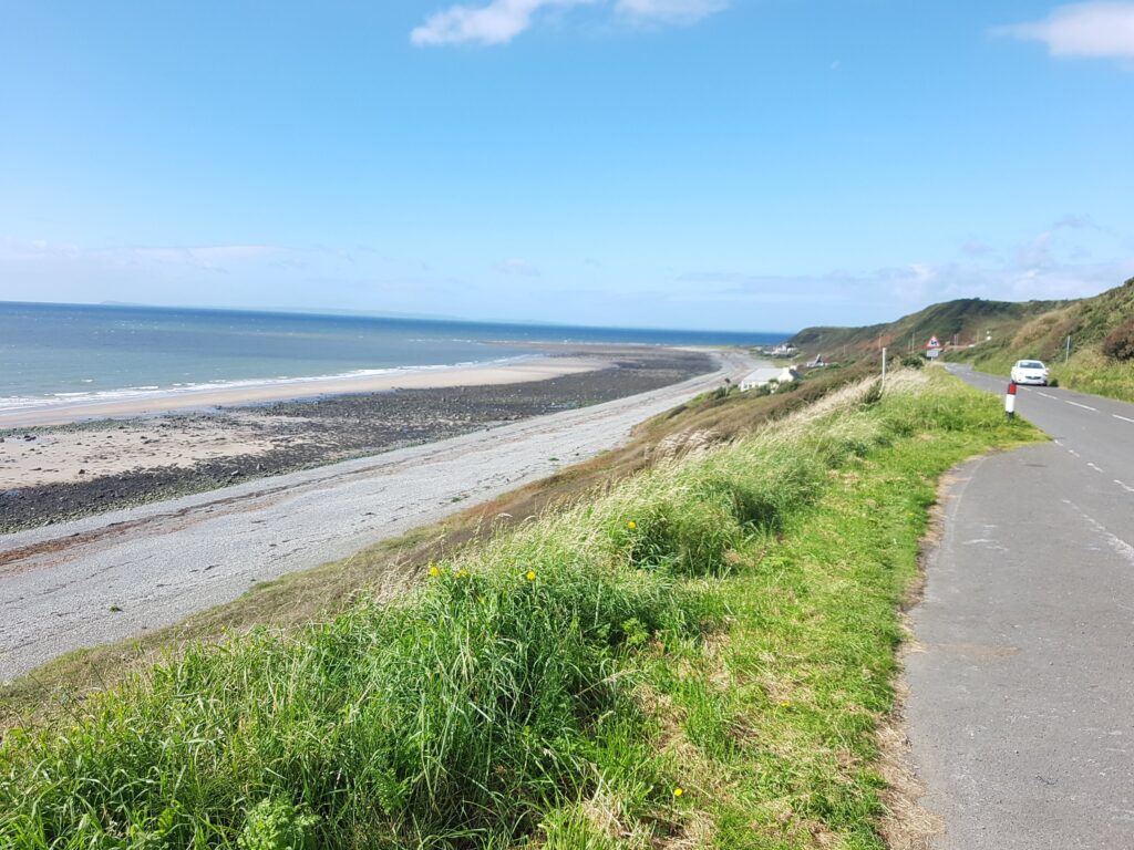
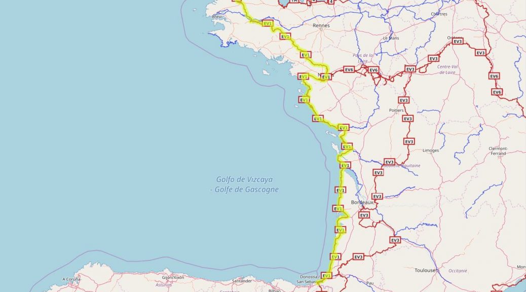
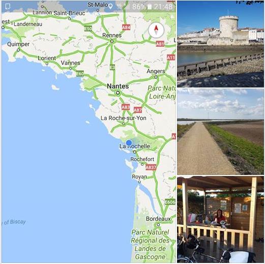
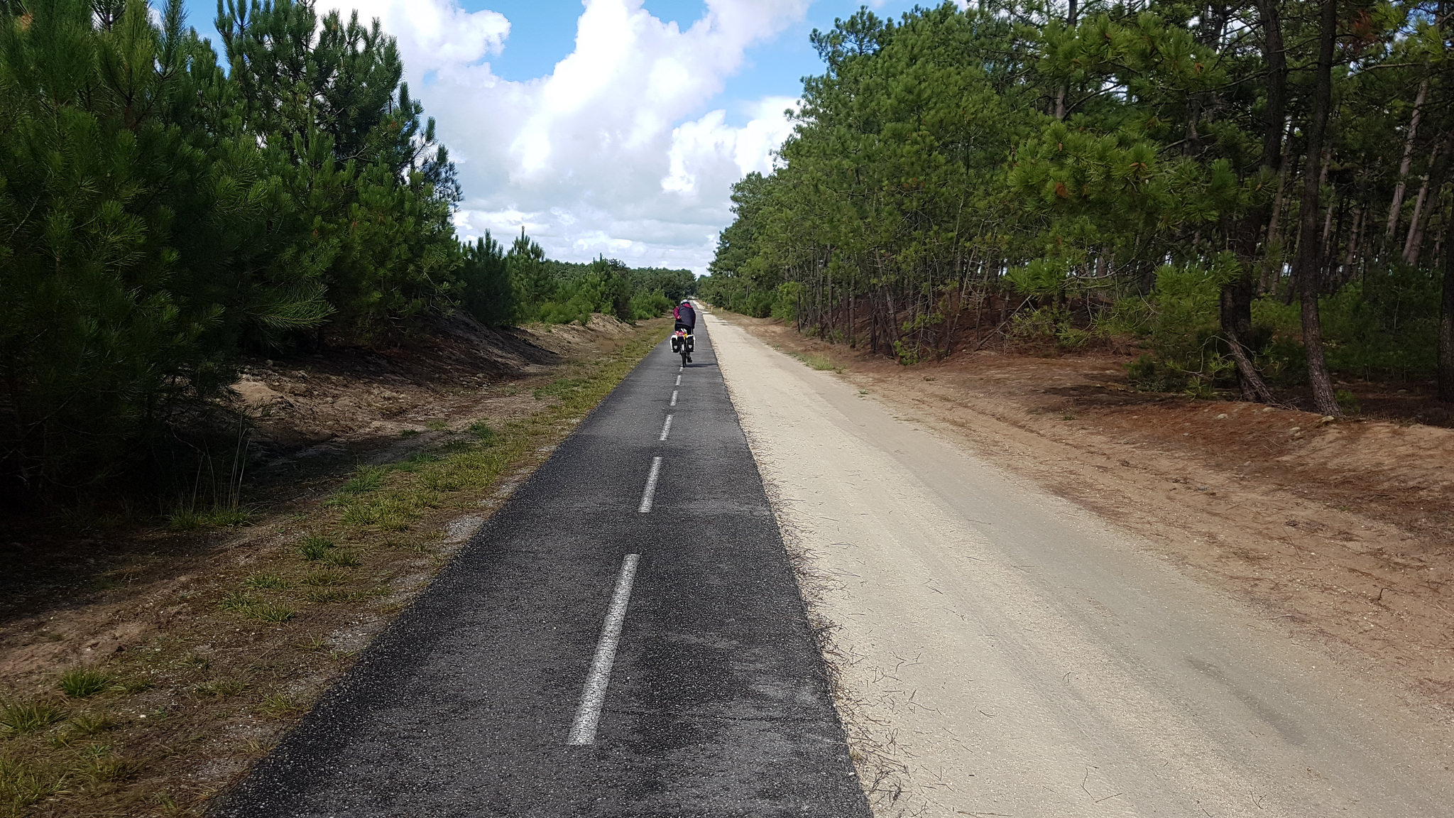
Stretching across the entirety of France’s Atlantic coast, La Vélodyssée is France’s longest cycle route. The route covers more than 1,200 kilometres from Brittany down the Atlantic coast to the border with Spain. La Vélodyssée forms part of the longer EuroVelo 1, named the Atlantic Coast Route. EuroVelo 1 is 8,186 km long and runs from North Cape in Norway to Sagres in Portugal.

Info available on the web:
Below are some web links to sites with info on the route:

La Velodyssee:  https://www.cycling-lavelodyssee.com/

Brittany Ferries: http://www.brittany-ferries.co.uk/guides/cycling/la-velodyssee

When to go:
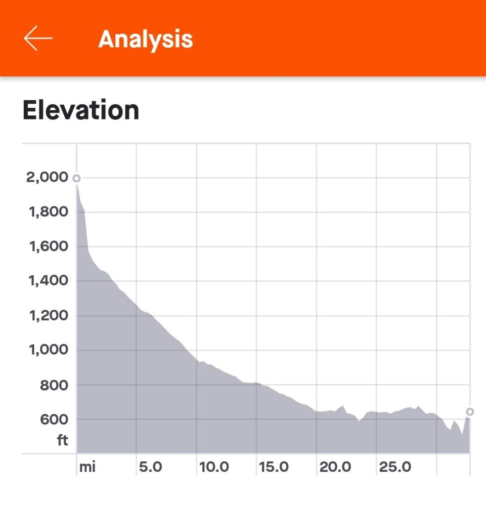
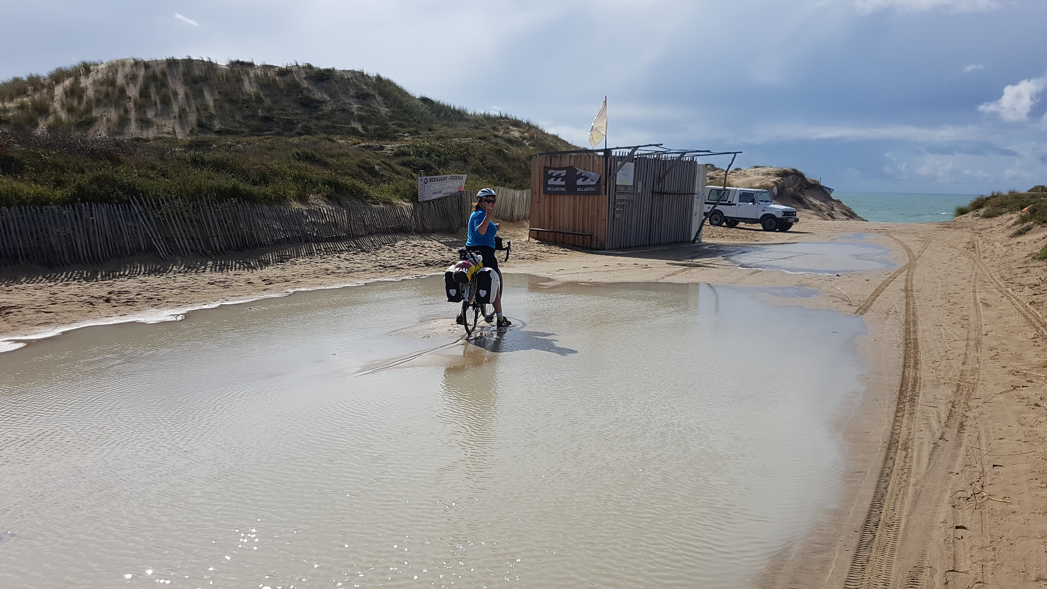
Jobs & kids limited when we could go – our window was September, starting on the 10th for 3 weeks. This is pretty late in the Velodyssee season & we found that some of the more northern camp sites were closed. The up side to this was that it was pretty quiet – we virtually had the route to our selves.

On the whole the weather was kind to us with only a few days rain. The temperatures were not hot but still T shirt & shorts cycling for most of the time. Night time temperatures dropped low & meant my thin Aldi sleeping bag was not really up to the job. I think if we were doing it again we’d only go about a month or so earlier. The temperatures would be warmer and we would still avoided school holidays. For us one of the joys of this route was it was not crowded ! The other advantage of going later in the season is that accommodation is slightly cheaper 🙂

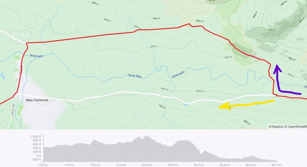
Route finding & Maps
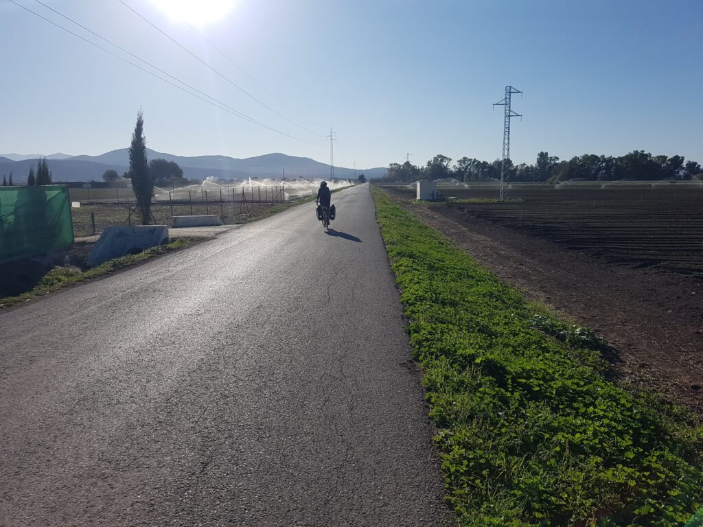
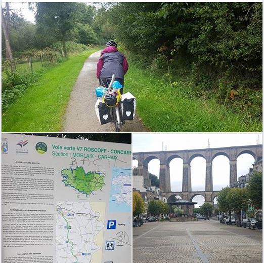
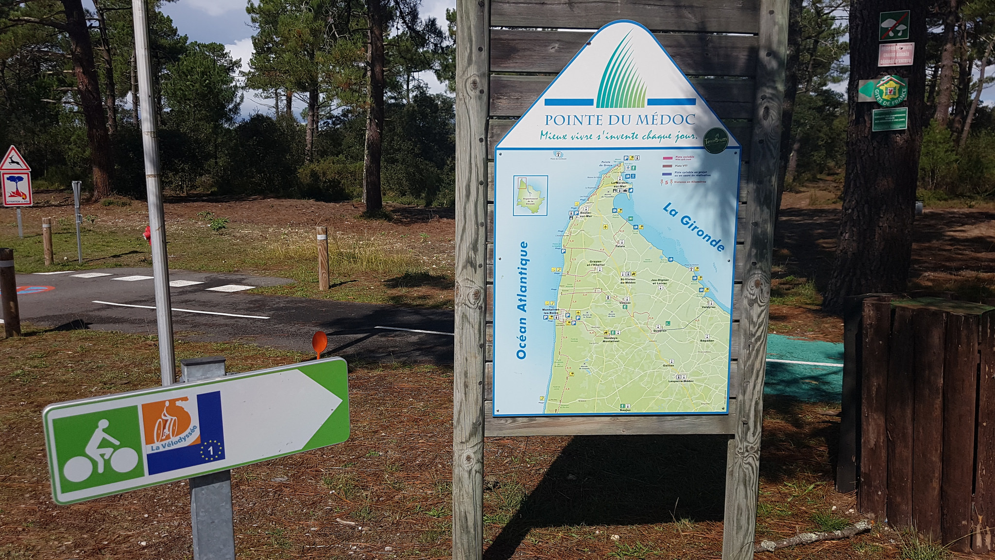
The route itself is pretty well documented on the Velodyssee site and is signposted between Roscoff and Hendaye with the logo on panels throughout the route. Depending on the region crossed, you may find different types of panel bearing “La Vélodyssée” logo.

So you have two real options for navigation…

1,   Map of the route + the waymarked signs.
2,  GPS mapping + the waymarked signs.

We opted for a mixture of the two. I took Michelin maps, or scans of with the route marked on it and I had the route on a phone app.

So how did it go ? Well the printed maps are far bigger than a phone screen and were useful for both of us looking at where we were & general planning. The maps didn’t work well for actual navigation because they had insufficient or no details – this is where the phone app came into its own.

The app, which could be zoomed in to street level showed a “you are here” and the route. I had the phone mounted on my handlebars with a rubber mount . This made it very easy to follow without constantly having to stop to refer to maps. I think the ability to know exactly where you are without having to concentrate on paper maps allowed us both to enjoy the sights more and not have to stop so often.

In summary I’m a convert to electronic mapping though there is a down side which is battery life. Constantly having the screen & GPS on uses the phone battery quickly – too quickly. Luckily I’d worked this out before going & had taken a USB battery charger & the bike had a dynamo hub. More on those later…

My phone is an android phone and the app I used was Maps.Me.  Onto this app I had loaded the .GPX route file which is available from the Velodyssee site. In addition to this I loaded waypoints for all the camp sites in France (details later). The only caveat to electronic mapping is rain. My phone is waterproof but the screen failed to respond when it was raining. I think it was my phones was saying it was time for a coffee stop !

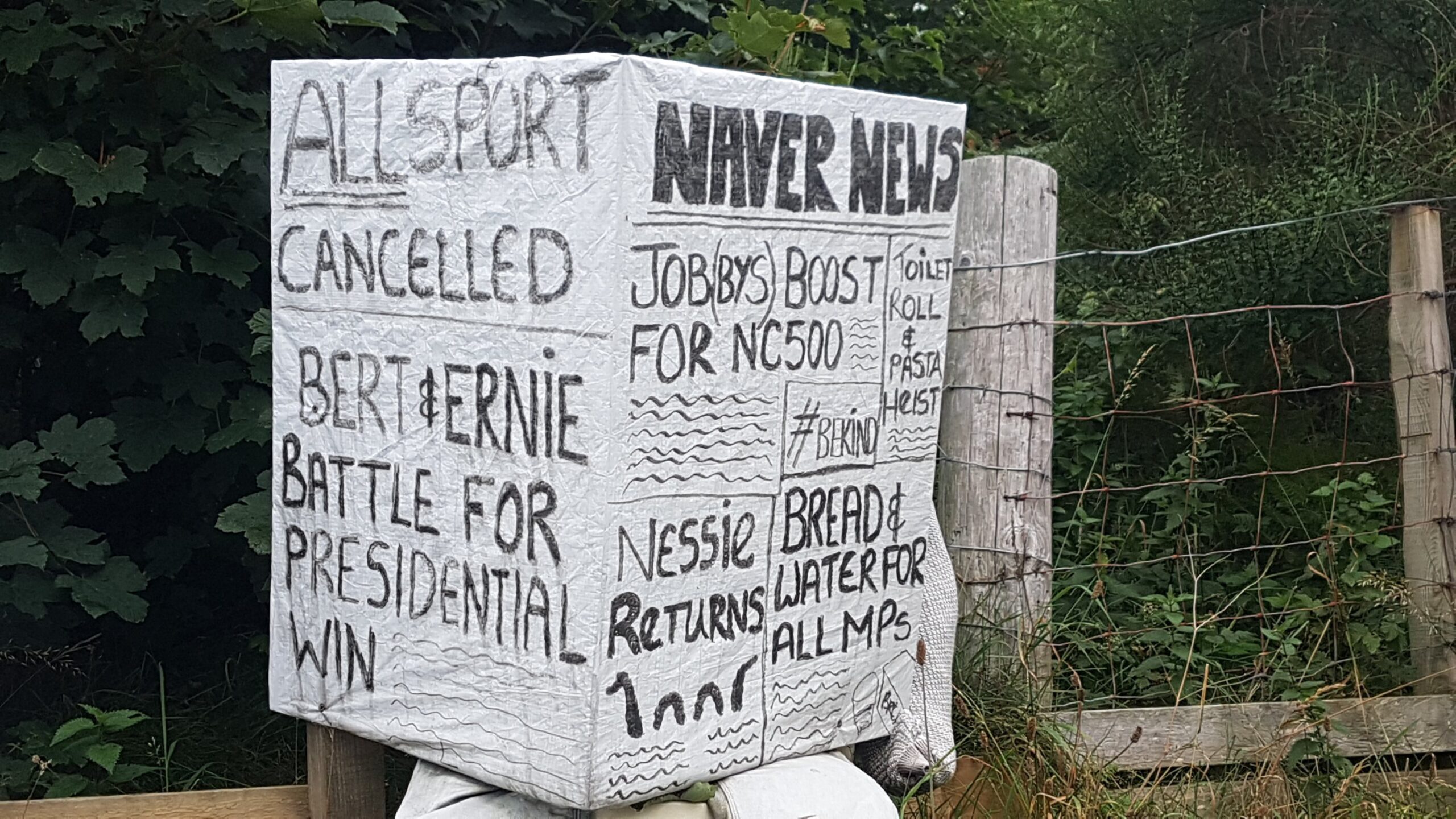
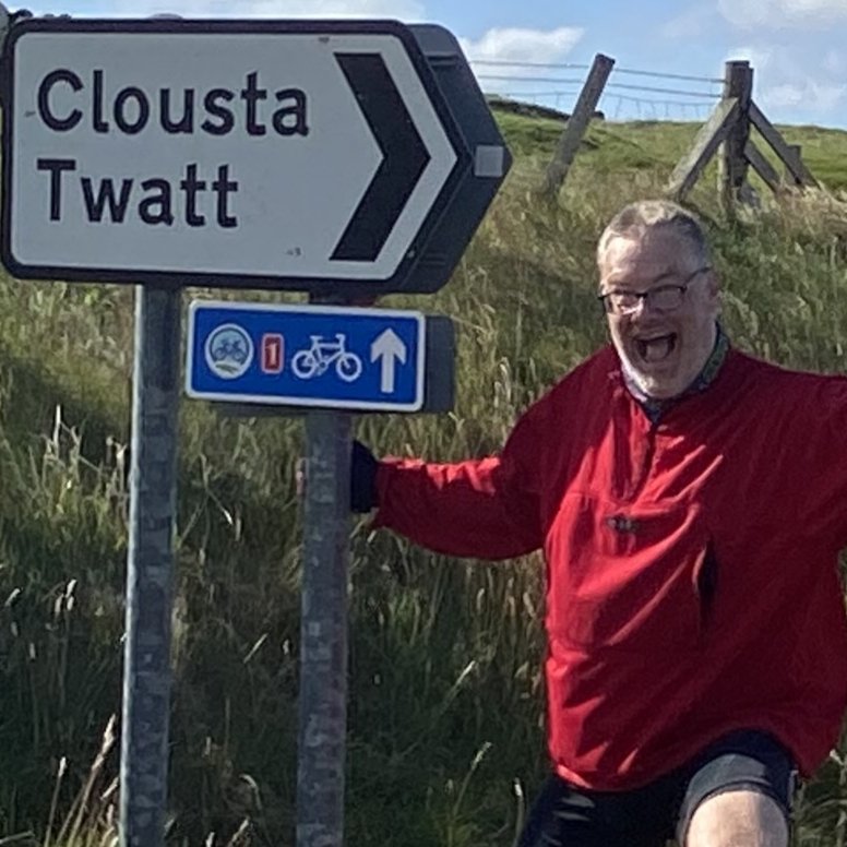
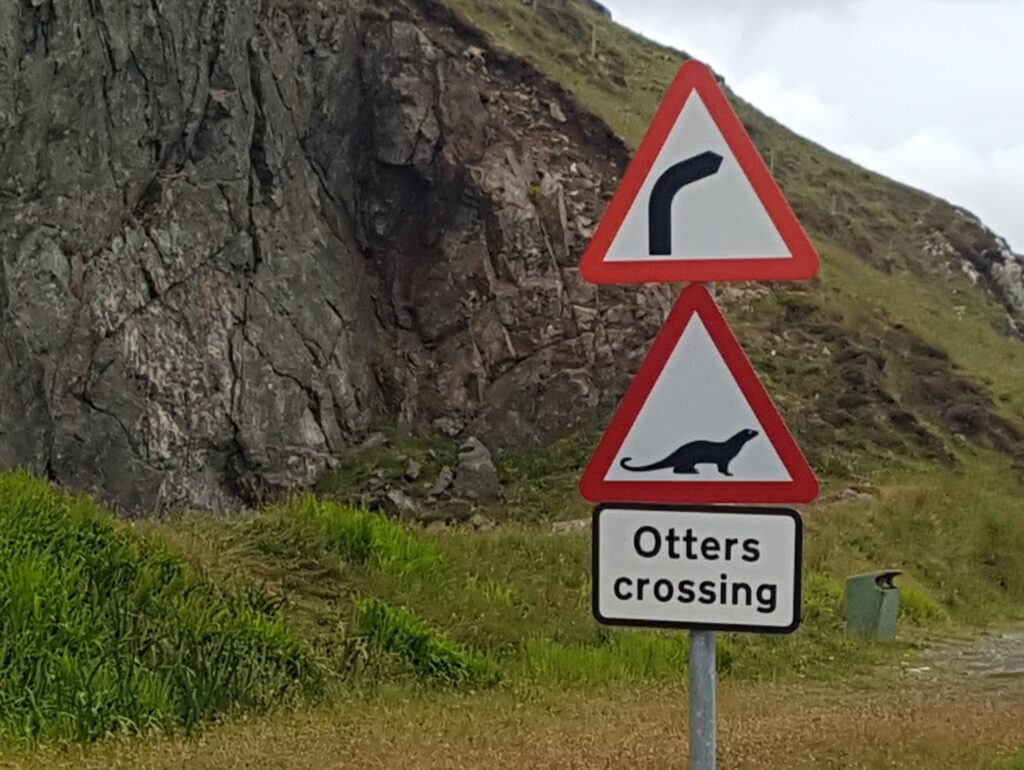
So what about the signs & fingerposts ? Well in some areas they were brilliant but in other & especially round towns a bit scant or missing.

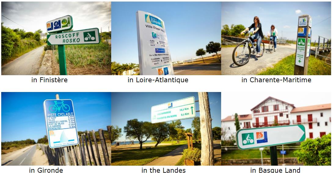
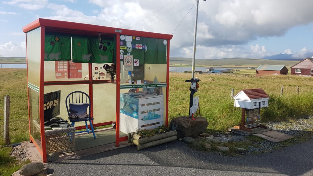
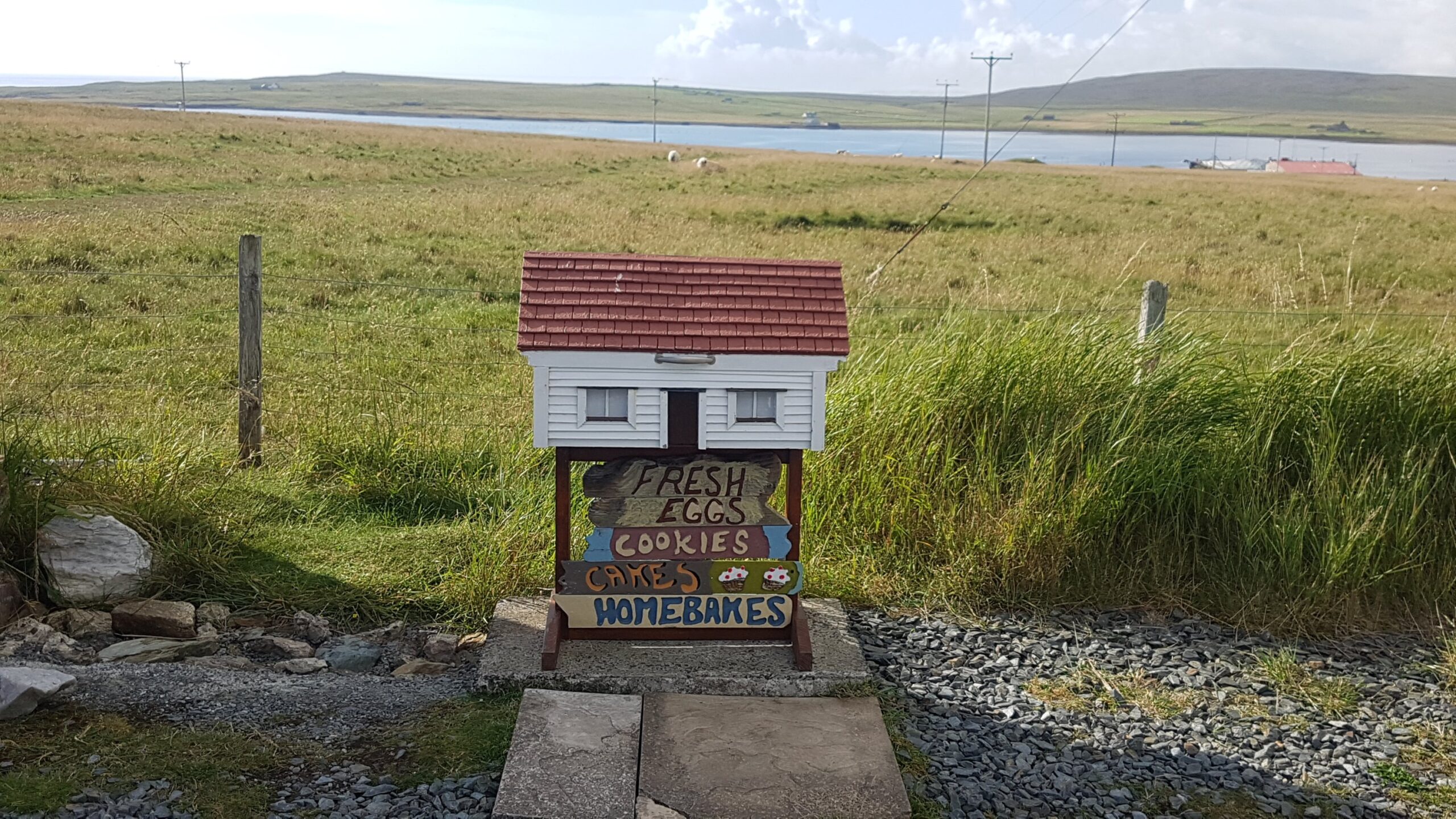
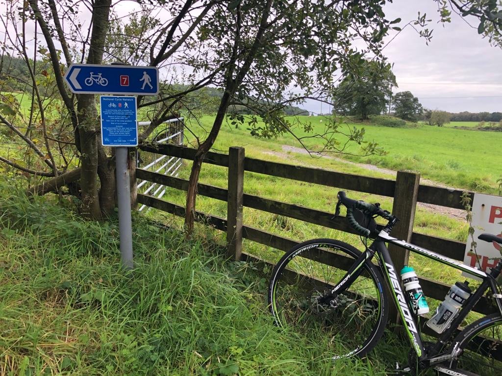
Examples of different signs used throughout La Velodyssee…

So the conclusion is that electronic maps are the way to go as long as you can keep your phone charged. So my advice would be – follow the signs but use electronic maps as well.

Which Direction ???
This got us thinking for a while….
Ideally we thought it would be best to start in the north & move south so as it got cooler through the month we would be moving towards the warmer south. There were two issues with this plan:

  1. The prevailing winds are south to north.
  2. The ferry home from Santander only runs once a week so if we missed the ferry by one day we had to wait a week to get home. Ferries from Roscoff were daily.

The ferry issue settled it & we decided to cycle south to north… If we were doing it again we may go the other way as we felt the southern half of the route was more pleasurable.

Travelling from the UK:
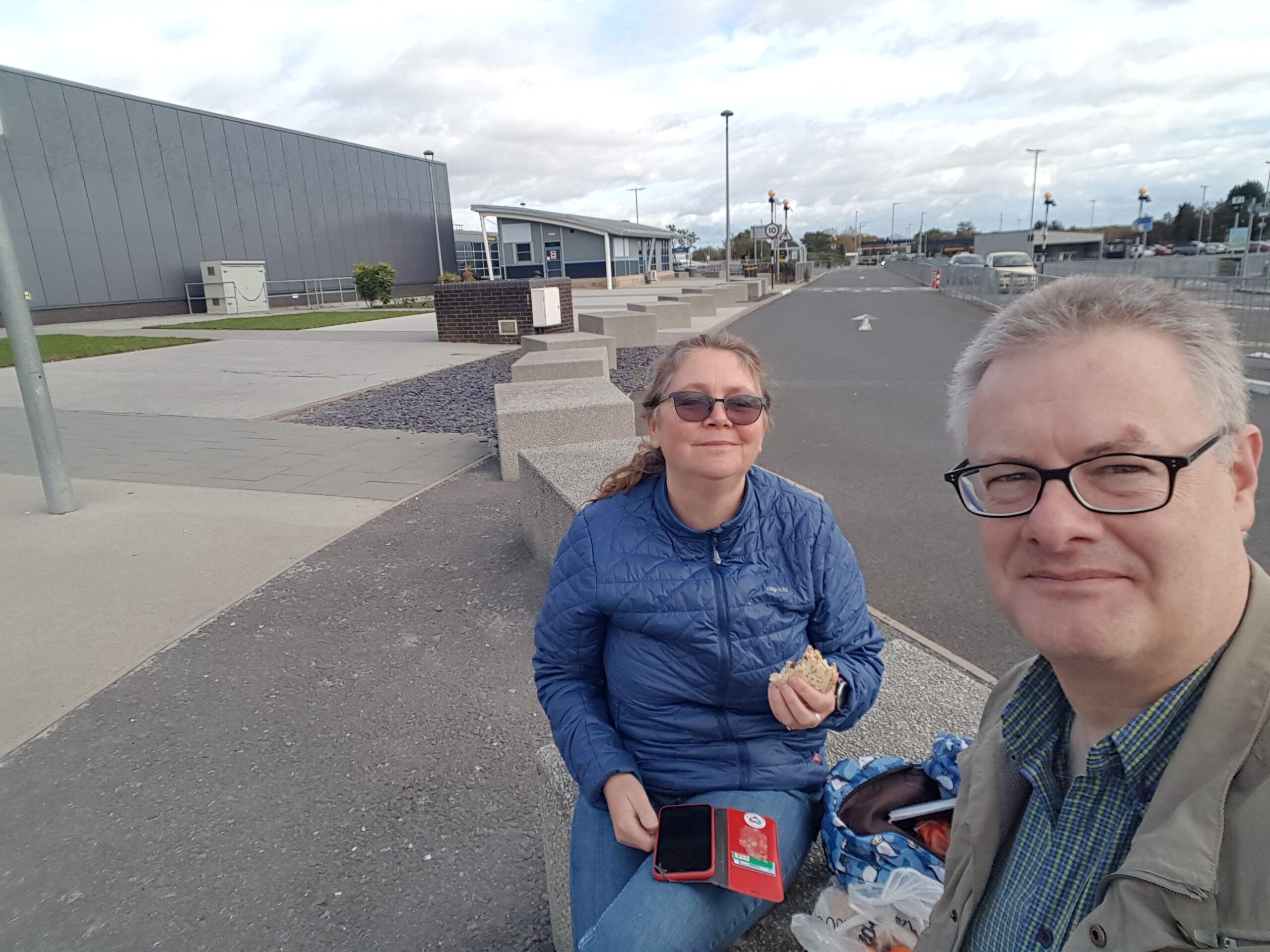
With the direction set I then looked at the logistics of getting to the start at Hendaye. In principal it seemed simple. Train from Penrith to Plymouth – ferry to Santander – Train from Santander to Hendaye. The return being ferry from Roscoff to Plymouth – train from Plymouth to Penrith & home for tea & medals…

Sadly nothing is that simple. The trains to Plymouth were very expensive and trains seem to hate bikes. So for this bit of the journey it was cheaper (and easier) to take the car & park it up for three weeks (yes it is madness). The storage company we used for the three weeks was SECURE OPEN STORAGE www.sosplymouth.co.uk Ok so that bit sorted…

Ferries – they are great. All easy there. The fun started when trying to sort train travel from Santander to Hendaye. The top line – there is no through train. You have to use different trains from different companies with different web sites. Joy… Anyway this is what I found.

The journey was

Train 1:    Santander – Bilbao change trains AND stations then…
Train 2:   Bilbao – Donostia, San Sebastian change trains AND stations then…
Train 3:   San Sebastian – Hendaye

Train 1 – time tables were found at:
http://www.renfe.com/EN/viajeros/feve/index.html

Train 2 – time tables were found at:
http://www.euskotren.eus/sites/www2.euskotren.es/files/E1_Matiko_Amara_0.pdf

Train 2 – time tables were found at:
http://www.transfermuga.eu/en/euskotren/

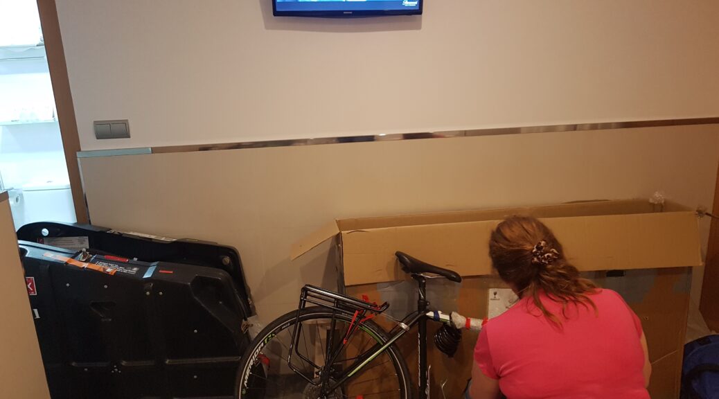
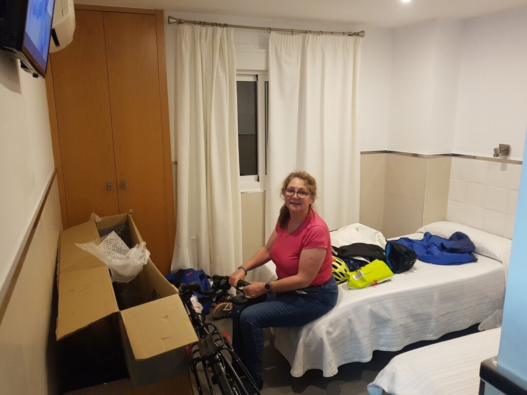
We had originally planned to take two days to get to Hendaye and have a stop in Bilbao.  As it worked out we managed to get to Hendaye in the day but arrived late ~11:pm.  There were no hotels open in Hendaye so it ended up being another couple of hours before we got the tent up somewhere – and all in the rain.
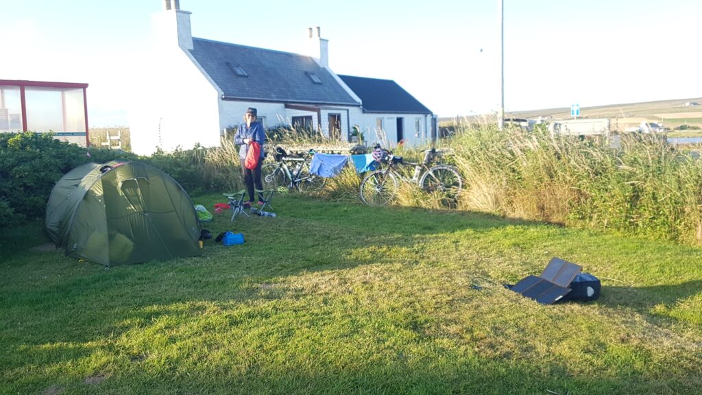
Accommodation:
We decided it would be fun to camp with the odd night in a hotel.  I got waypoints for all the French campsites on my phone app. I used Maps.Me and the waypoints from www.archiescampings.eu/ This was a big help along with Google maps come the end of each day for finding campsites. I can’t remember the exact method for putting the GPX files and waypoints into Maps.Me but if you need a hand email & I’ll work it out & let you know.

Bikes and equipment:

Bikes:
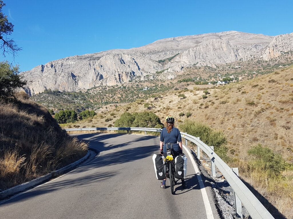
We took Dawes Galaxy tourers with rear pannier racks & Schwalbe Marathon Plus Road tyres (32c). This setup was great for the vast majority of the route with only a couple of muddy sections where off road tyres would have helped. With regard to gearing – both Dawes have triples. The granny ring was only used once in the north where there are a few hills. Apart from that the route is pan flat !

Spares & tools:
We decided France wasn’t a third world country 😉 so we didn’t need to take loads of spares. Just basics were taken.

Luggage:
Pack light for speed or pack for comfort – decisions decisions…
We decided that as we were away for three weeks we’d pack for comfort. So we took

  • Ortlieb rear panniers
  • Aldi Dry bag
  • Ortlieb bar bag
  • Topeak top tube bag
  • Topeak saddlebag for tools.

The dry bag was filled with tent, stove & sleeping gear. This was strapped with bungees between the two rear panniers. This seemed to work well with bungees providing flexibility to secure shopping as well.
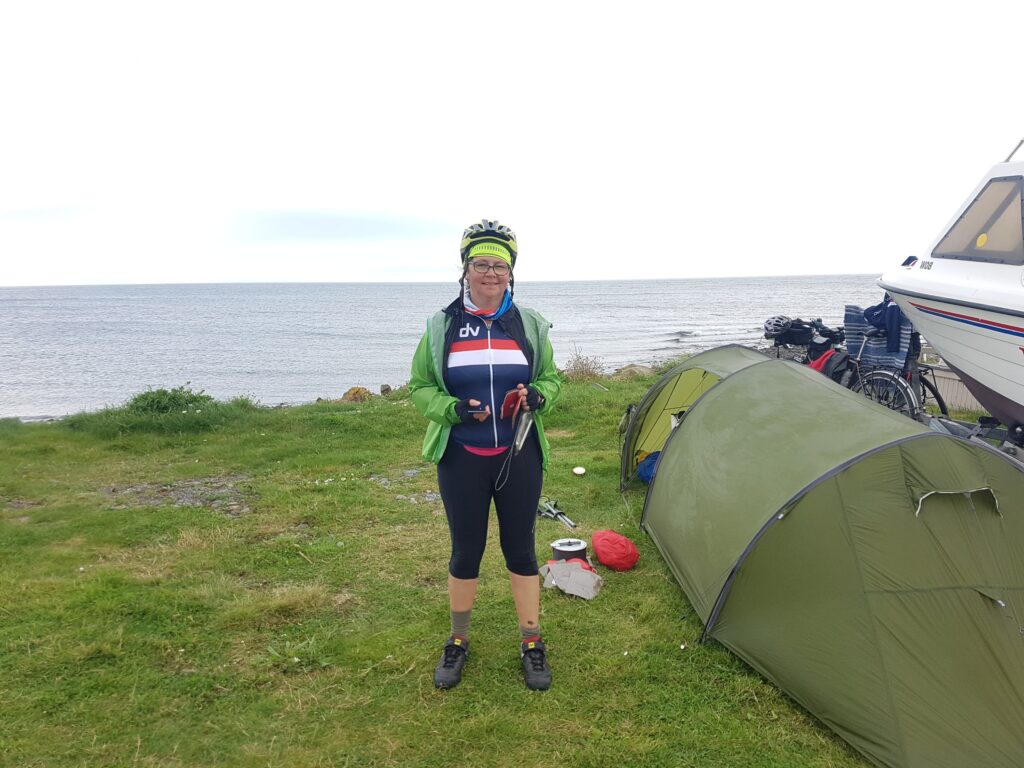
Tent:
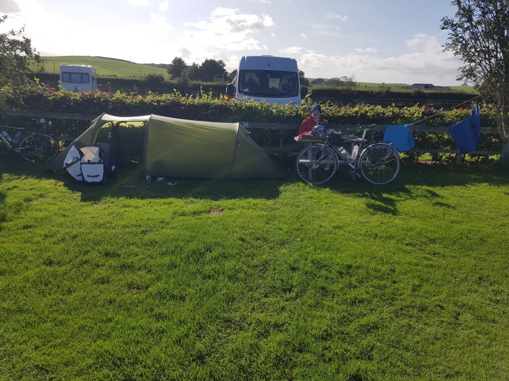
None of our tents were suitable so we had to purchase new. Neither of us are spring chickens any more so we wanted some space & comfort in a tent. Also I didn’t want too much weight. Days of research later we settled on the Vango Xenon Ultralight 2 https://www.vango.co.uk/gb/tents/1183-f10-xenon-ul-2.html

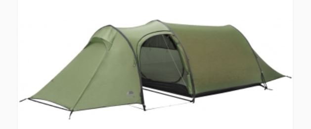
This tent did work well. Its good points are:
• Light 2.1kg
• Easy to put up – important when its pissing down…
• Big enough for two normal people to sleep without being on top of each other
• Gear storage in the front porch
• Oversized stuff sack – this made packing up considerably easier.

In conclusion this tent worked well for us & I would recommend.

Sleeping bags & Mats:
Sarah took her trusty down bag & I purchased a new synthetic lightweight 2season bag from Aldi. The Aldi bag packed small & light but it ended up not providing enough warmth for the cold October nights. In addition it was a little small (tight) on my 6’1” 105kg frame. Since the trip I’ve purchased a Decathlon bag – it’s a little bigger and heavier but works better for me.

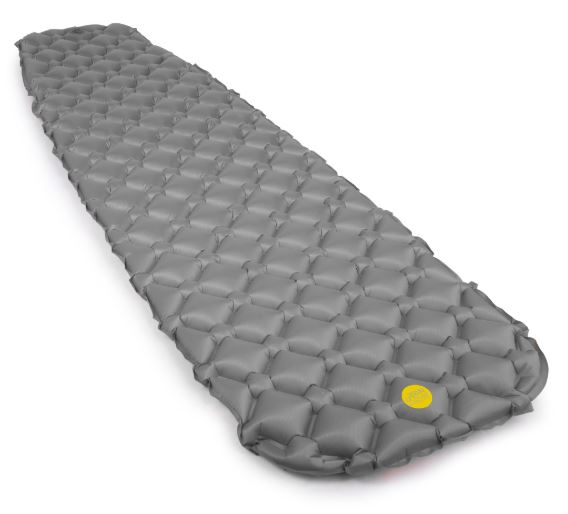
Both of us had old Thermorests. These were both heavy and bulky so we looked for alternatives. Not an easy choice as our old bones needed comfort but without the bulk & weight. Again after endless internet hours we ended up buying Alpkit Cloudbase sleeping mats.

The cloudbase is an inflatable airbed who’s material has no insulation properties. It inflates to a thickness of 5cm. The material it’s made from looks thin, it packs up really small ( ⌀ 8 x 28 cm) and weighs 415 g.

Initially I was dubious but went for it thinking if it did fail under my bulk (105kg) then we’ll never be far from an Decathlon in France ! It did work well, I shall be using again and can recommend.

Other Kit:
We both took seats with us. Madness I hear you all saying ! Well the thinking was that we’d be spending time in camp sites & it would be comfier/less painful/ dryer not to be sitting on the ground when cooking / relaxing.   Sarah took a Heliox seat & I took a stool. They were just bungeed onto the rack with the dry bag – simples…
They did work well & I would take again for longer trips – you can’t beat a bit of comfort !
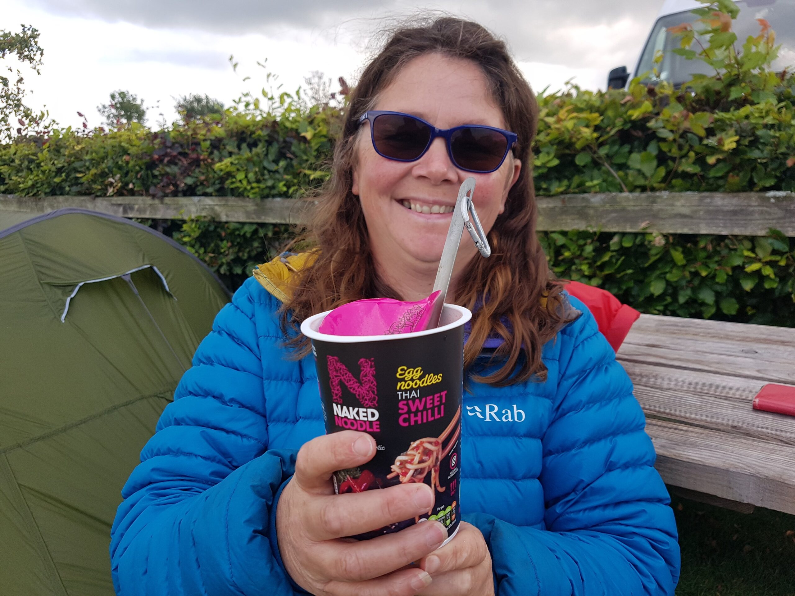
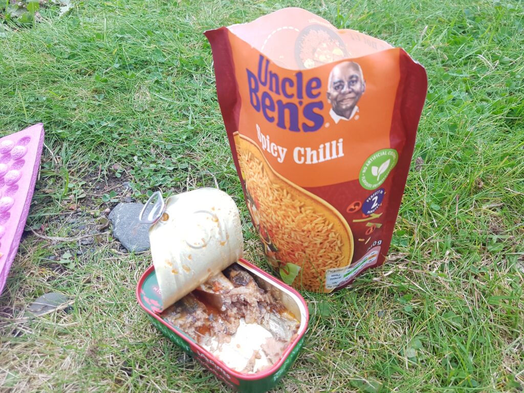
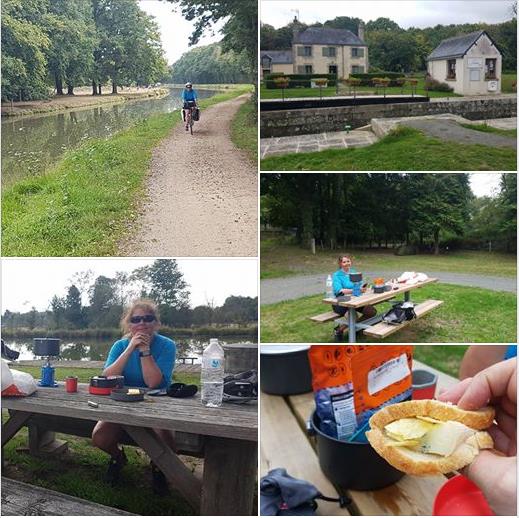
Stoves & Pans:
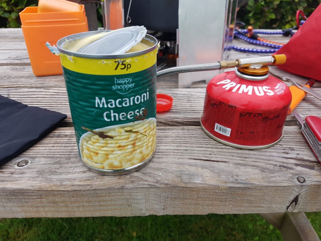
We purchased a Primus Omnifuel stove for the trip. Sadly some clown forgot to pack the gas hose so I cannot report if it was good or not. We ended up carrying it for the whole trip + another cheap stove from Decathlon.
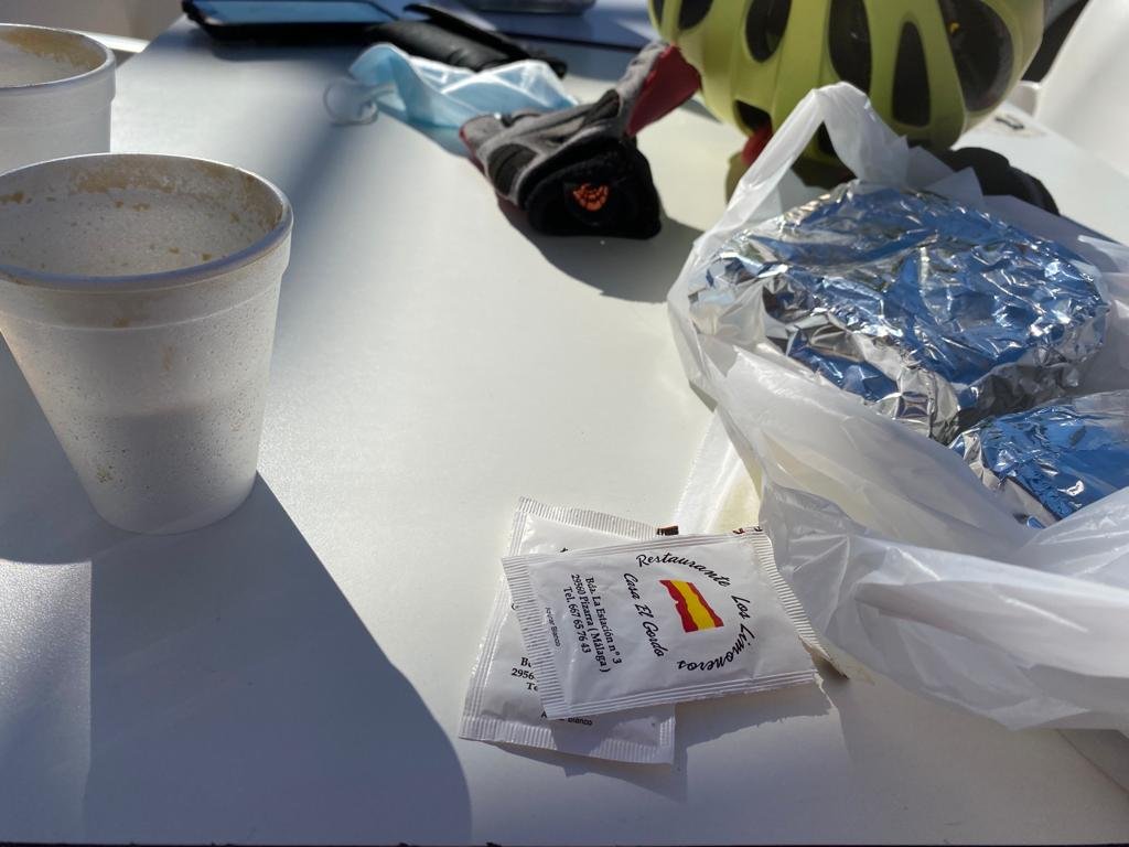
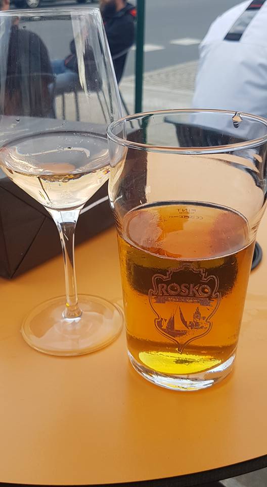
For pans we took a two pan & cup set , a couple of titanium spoons and a swiss army knife. This worked well & I don’t think we wanted for more cooking stuff. The knife did for wine corks & cutting baguettes & cheese.

Electricity:
I thought keeping phones, lights, USB power banks, Garmins all charged would be an issue if we didn’t get mains every night. So after more internet hours I ended up buying a new front wheel with dynamo hub. The thought being that the variable voltage & current from this could be regulated and used to charge a USB power bank. Simples….

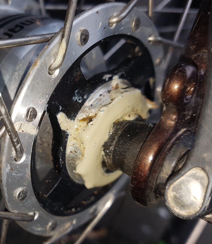
Great in theory but ended up being a fail. The wheel build from Spa Cycles had the wrong dyno hub put in – one that was not up to charging stuff. I didn’t realise this until we were on the trip so the system I’d setup just didn’t charge. After the trip Spa Cycles were great & rebuilt the wheel with the correct hub – it now works great.  If you’re thinking of getting a Dynamo wheel made up I would recommend Spa Cycles. Errors can happen – we are all human. What is telling is how people & companies react – Spa were brilliant & the staff are very knowledgeable.

…but for the trip we relied on the USB power banks. We charged these whenever we could & were ok for the trip. Its good to have a USB mains charger with 4 outlets this allows several things to be charged simultaneously if there is only one socket. Sometimes we had to leave the power banks charging over night in the camp site toilet blocks. Lucky they were not nicked…
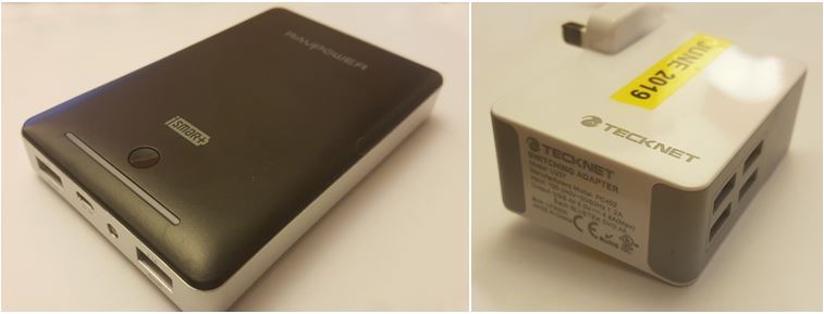
Conclusions…

We loved cycling the Velodyssee…   The route, the country & people were brilliant. Yes there are a few small issues with route markers on the odd occasion but that’s trivial and part of the adventure.  I would say it’s a great introduction to cycle touring – a sort of cycle touring lite ! Why do I say that – well because it’s so setup for looking after cyclists.
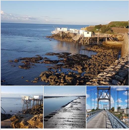
If you’re strapped for time & can’t do it all I’d say do the southern part from Nantes (or La Rochelle or Royan) down – that was our favorite part.  Would we do it again – yes, but I think it will have to wait till retirement…
If you’re reading this then you’re probably looking at doing the Velodyssee. Great – just do it, you won’t regret it. If you are new to touring and have questions please email us & we’ll try to help.

If you’ve found any of this interesting and you want to read more the link below takes you to the start of the blog…

Velodyssee September 2019: Nick & Sarah’s mini Adventure….

Day 19 Roscoff   28/9/17

Day 19 Roscoff   28/9/17

We made it!    Cycled 774 miles. Hendaye to Roscoff.


Having been cycle tourists for the last three weeks we’re reverting to type and becoming pissed Brit tourists ?

Decided we just want to carry on cycle touring Europe. I’m just wondering how long it would be before work noticed I wasn’t there and stopped paying me ?


Day 18: Carhaix to Morlaix 27/09/17

Day 18: Carhaix to Morlaix 27/09/17

Distance today: 31.1

Total distance: 754.3

Disasters: 1 – Sarah’s mudguard fell off…


Today started with a hearty breakfast served by our friendly hotel owner. The hotel was slated on tripadvisor but we liked it – for no other reasons than he was friendly and the shower was great.

We rejoined our route which now changed from canal to a “green route” which means mud and gravel paths. Again the scenery was beautiful but we made slow progress because the paths were soft and very slippy in places.

All was good until the rains came at about 2pm. At this point we were only 4 miles from Morlaix so a decision was made to stop here for the night to see the bad weather out. This made it a short day but we’re in no rush as the ferry isn’t till Friday.

We spent the rest of the afternoon exploring Morlaix & it’s large viaduct while our tent is drying in the hotel bathroom. With only 15 miles to go tomorrow really should be our last day cycling


Day 17: Pontivy to Carhaix 26/09/17

Day 17: Pontivy to Carhaix 26/09/17

Distance today: 55.4

Total distance: 723.2

Disasters: zero

Perfect start to the day – warm clean dry hotel room. Only problem is the room stinks – probably because everything we own now stinks. Sarah isn’t happy about this and stars having some deva like behaviour demanding some new clothes & wanting to burn the old ones. Luckily no shops were on route ?

Easy miles in the morning dispite some stiff legs. The route continued on the Nantes-Brest canal which again was beautiful. Lunch was a fromage baguette by La Blavet, a large resovoir.

We continued down the canal till a “route ferme” sign. The “deviation” went up a serious hill so Sarah decided to ignore the signs. Beautiful route & no problems until the route was blocked by a guy with a mini-digger digging the route up ! Sarah used her feminine charm and persuaded him to move the digger and let us past.

About the 40 mile mark we’d run out of water and were getting seriously thirsty. There aren’t many cafes on route so we were happy to spot one of the lock keepers cottages was a cafe – problem was it wasn’t a cafe just some Brits drinking in the garden of their house. Anyway to cut a long story short they gave us water and several glasses of wine ? lovely people and they were southerners !

Wine fueled we easily made it to Carhaix & another hotel – campsite closed. Only one days cycling left to the finish


Day 16: Redon to Pontivy 25/09/17

Day 16: Redon to Pontivy 25/09/17

Distance today 69.9

Total distance 667.8

Disasters 2

Miserable nights sleep due to heavy rain. We both woke early to find our super new tent had leaked. The rain made packing up difficult and delayed departure till 10am as everything was either wet or covered in mud or both.

It was slow going to begin with as the gravel paths were water logged. This ment everything got covered in a spray of muddy gravel. By lunch the rain had cleared and we began to appreciate all the beautiful scenery and the lock keepers houses that were immaculate and decorated with flowers.

We met two brits who told us about a good hotel at the 60 mile mark in Rohan. We detoured to the hotel but to our disgust it was permanently closed – ahhhh. To cut a very long story short this meant an extra 10 miles on to a hotel in Pontivy. 70 miles on gravel track after no sleep was a big day out for both of us – we will sleep well tonight…


Day 15: Nantes to La Touche Saint-Joseph.  24/9/17

Day 15: Nantes to La Touche Saint-Joseph.  24/9/17

Distance today 59.1

Total distance 597.9

Disasters zero ? (sorry Will)


Hotel starts are always easy as you don’t have to pack your tent and someone makes you breakfast. We were on the road by 9:45 having cleaned and oiled chains.

Navigating out of cities can sometimes be a nightmare but this was a lovely quick route. After 25 miles we joined the towpath of the Nantes – Brest canal. This was beautiful and ran for 35 miles to our camp site. The site is small but has benches which is always a bonus.

We didn’t find any shops on route so had to eat our emergency dried food packs + cheese and crisp sandwiches. Then showered & in bed by 8pm. We’ve decided that everything we own now stinks – even the new tent has a mouldy aroma. If all goes to plan we’ll complete the 760 miles in three days


Day 14: Nantes. 23/09/17

Day 14: Nantes. 23/09/17

Distance today zero

Total distance 538.8

Disasters zero ?

Today was a day off cycling – think we needed a day off !

We got up late & had a wander (without bikes) round Nantes. The highlight of our walk was the Machines de l’ile.

Les Machines de l’ile is an artistic and cultural project based in the old covered buildings of the former shipyards in Nantes that were at one time used for ship construction.

The Machines are created by two artists, François Delarozière and Pierre Orefice and aims to promote the city’s image and tries to “build an identity as a creative metropolis of dream and of fantasy”.

Anyway it was really interesting & we had a grand day out ? Back to cycling tomorrow.


Day 13: Pornic to Nantes. 22/9/17

Day 13: Pornic to Nantes. 22/9/17

Distance today 60 miles

Total distance 538.8

Disasters zero ?

We’ll we’ve cracked 500 miles today. The daily milage aren’t huge but I think we’ve done ok as we’re on heavy bikes with 20+ kg of stuff + food & water. We’re both feeling a little sore so tomorrow is a rest day in Nantes. We need some rest I think as it’s just gone 9pm & we’re in bed already !

The route changes from Nantes as it moves inland. The next time we’ll see the sea is at Roscoff. Hopefully more quiet roads and less sandy tracks. Just hope the weather holds. Need sleep – night night xx


Day 12: Saint Hilaire de Riez to Pornic 21/09/17

Day 12: Saint Hilaire de Riez to Pornic 21/09/17

Today’s milage 51

Total milage 478.8

The day started early with a to the shops to get breakfast but more importantly a 2 euro coin for the dryer as all our clothes were still wet.

Coffee and croissants in the cold morning air as the clothes dried then on the road by 9:30. The route was a mix of tarmac and gravel/sand paths that followed the coast except for some detours around salt marshes. The weather held until 2 miles out of Pornic when it started to rain. The dark clouds stretched to the horizon so a decision was made to get a hotel. Trivago was consulted and we found a place the Brit Hotel Les Alizes. The nice guy on reception told us of a decent restaurant & a nice night was had.


Day 11: Aiguillon sur Mare to Saint Hilaire de Riez. 20/9/17

Day 11: Aiguillon sur Mare to Saint Hilaire de Riez. 20/9/17

Today’s mileage 60

Total mileage 427.8

Disasters 1

Woke to a sea mist this morning after a very cold night. The Aldi sleeping bag just isn’t up to single digit temperatures !

Several cups of coffee saw us on our way by 10am. Tarmac paths took us quickly to the large city of les Sables D’Olonne which was beautiful. From Sables we followed the coast on gravel/sand/mud paths which passed some beautiful houses. This section of the route is more populated than the southern section but there is still loads of space compared to the UK.

Found another lovely camp site on the coast. The site has washing machines * dryers so we decided to do all our washing before going out for food. After getting the correct coins from other campers we set the dryer going and went off for food. The nearest restaurant was part of a bowling alley – we were tired and hungry so went for it. It turned out to be a fantastic really up-market restaurant. The food was wonderful but the very camp waiter really didn’t like us. Maybe it was because we were really scruffy and were wearing clothes wed slept in the night before. Anyway great food but zero tip ?

On returning to the camp site we went to retrieve our dry washing. In hindsight the cool “delicates” cycle wasn’t the one to go for – all our clothes for tomorrow are still wet !


Day 10: La Rochelle to L’Aguillon sur Mare 19/09/17

Day 10: La Rochelle to L’Aguillon sur Mare 19/09/17


Today’s milage 48

Total milage 367.8

Disasters 1

Woke up to brilliant sunshine and had a lazy start as we were both a little stiff after yesterday’s 70 miler. The Disasters of the day was Sarah not getting the best nights sleep because her new inflatable camping pillow had sprung a leak. Investigations in the shower showed it was beyond repair so a detour to decathlon in La Rochelle was planned.

La Rochelle was a beautiful city well worth a return visit. The cycle route through the city was not easy to follow – impossible without a gps.

After La Rochelle it was open farm land and canals. The cycle tracks were no longer smooth tarmac but gravel and mud. This made for the slow progress today. We arrived at a camp site after closing but we’re welcomed in – really nice people. The Municipal de La Biae is well worth a visit. They even have a special area for cyclists with benches


Day 9: Royan to La Rochelle.  18/9/17

Day 9: Royan to La Rochelle.  18/9/17

Today’s mileage 71.1

Total mileage 319.8

Desasters zero ?

Today was a game of two halves. Royan to Rochefort was beautiful with everything from rugged coast to salt marches. Again all on lovely smooth tarmac cycleways. Towards Rochefort this changed to mud track then industrial landscape – this was no fun, especially as sections were on road with big lorries. We returned to cycle path after Rochefort but this range beside a motorway so was far from idyllic. Finally found a nice camp site just short of La Rochelle. Over 70 miles for the day not bad !


Day 8 Royan  17/9/17

Day 8 Royan  17/9/17

Today’s mileage 0 – rest day.

Total mileage 248.7

Today’s disasters 1


The forecast was pretty miserable for today so we decided Royan would be good for a rest day.

Just did tourist stuff today so really not much to say. Royan is a lovely seaside town and we had a good wander round.

The only disaster today was opening the door of a new style auto cleaning public toilet to see a French man having a shite. This was a deeply disturbing site that I cannot unsee…


Day 7 Lacanau Ocean to Royan 16/09/17

Day 7 Lacanau Ocean to Royan 16/09/17

Today’s milage 53.7

Total milage 248.7

Today’s disasters 2


Today started with the sound of rain again and it was cold – around 12°.

The first disaster of the day was leaving one of my cycling shoes out in the rain all night – again.

We quickly packed in a lul in the rain and put bikes and gear in the covered table tennis area while we had a croissant for breakfast. We set off north in light showers for the ferry at la Pointe de Grave.

We then did 30+ miles in forest wilderness with only a single tomato for sustenance – no shops anywhere. When we finally reached Montailvet we were starving and dived into the first cafe – a small surf bar called Williwood. We had a quality burger, frites and beer before continuing to the ferry. This is when the second disaster occurred – while putting my jacket on I felt a sharp pain in my finger – to cut a long story short I’d been stung by a wasp that was trapped in the lining of my jacket. I’ve never been stung by a wasp & it’s actually really painful with my finger swelling considerably.

With the sun on our backs and fueled by quality sports food sped off to make the 5pm ferry overtaking several eBike on route ?.

It was refreshing to see the French don’t go for health & safety crap an allowed all the bikes to ride onto the ferry. Strangely young and old all managed it without fatality! As Sunday is heavy rain we are hoteling tonight and may well have a rest day tomorrow.

P.S.

Thanks for all your messages of concern following the wasp attack. Due to the high number of messages I can’t reply to all in person ?

It was touch & go for a while yesterday but I survived the night. The swellings down a little but it still feels like its been hit it with a hammer !

On a serious note it’s amazing how such a tiny amount of venom through a puncture too small to be seen can have such an affect the human body..